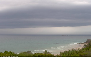
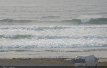
The weekend looks pretty poor, but a better quality groundswell is expected mid-next week, generated by a nice low in the lower Tasman Sea on Monday. More in the Forecaster Notes.
Primary tabs
/reports/forecaster-notes/south-east-queensland-northern-new-south-wales/2019/12/13/one-halfway
thermalben
Friday, 13 December 2019
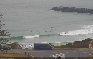
/reports/forecaster-notes/south-east-queensland-northern-new-south-wales/2019/12/11/might-be-good
thermalben
Wednesday, 11 December 2019
With a low swell outlook it’s not really worth worrying about too much. More in the Forecaster Notes.
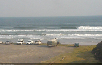
/reports/forecaster-notes/south-east-queensland-northern-new-south-wales/2019/12/09/flukey
thermalben
Monday, 9 December 2019
We’ve got a tricky week of local winds, which will have a major bearing on surf quality in a few regions. More in the Forecaster Notes.
/reports/forecaster-notes/south-east-queensland-northern-new-south-wales/2019/12/06/and-de-southerly
thermalben
Friday, 6 December 2019
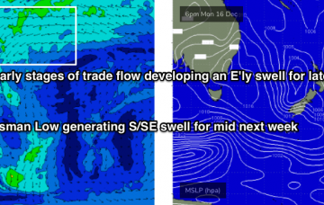
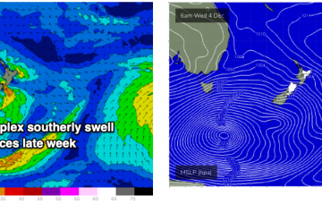
The parent low to all of the fronts responsible for this week’s seemingly endless southerly swells is now moving out from beneath the Tasmanian swell shadow (see chart below), and will generate building S’ly swells into Sunday. More in the Forecaster Notes.

/reports/forecaster-notes/south-east-queensland-northern-new-south-wales/2019/12/04/more-southerly
thermalben
Wednesday, 4 December 2019
We’ve got a stack of south swell on the way for Northern NSW. But, I don’t think the models are handling the outlook well, and are undercalling wave heights, as they are today. More in the Forecaster Notes.
/reports/forecaster-notes/south-east-queensland-northern-new-south-wales/2019/12/02/long-run
thermalben
Monday, 2 December 2019
We have much more promising swell sources developing to the south, for Northern NSW anyway. More in the Forecaster Notes.
/reports/forecaster-notes/south-east-queensland-northern-new-south-wales/2019/11/29/plenty-swell
thermalben
Friday, 29 November 2019
Now, the dominant feature for next week is an amplifying node of the Long Wave Trough across South-eastern Australia from Sunday evening onwards. More in the Forecaster Notes.
/reports/forecaster-notes/south-east-queensland-northern-new-south-wales/2019/11/27/couple-windows
thermalben
Wednesday, 27 November 2019
The parent low to this morning’s S’ly change was quite strong, and has produced solid 4ft+ surf across Southern NSW today. This swell will push across Northern NSW overnight and then begin to steadily ease back, so you’ll need to make the most of the early session for the most size. More in the Forecaster Notes.
/reports/forecaster-notes/south-east-queensland-northern-new-south-wales/2019/11/25/brief-windows
thermalben
Monday, 25 November 2019
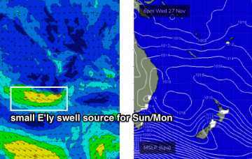
The S’ly change will be the dominant feature on Wednesday, but it’s worth mentioning that we may see a small E’ly swell in the water across SE Qld, from a low that spun up just NE of New Zealand over the weekend. More in the Forecaster Notes.
/reports/forecaster-notes/south-east-queensland-northern-new-south-wales/2019/11/22/yeah-nah
thermalben
Friday, 22 November 2019
Northerly winds will remain the dominant feature for the next four days. More in the Forecaster Notes.
