This synoptic pattern ain’t a good look for anywhere local. More in the Forecaster Notes.
Primary tabs
/reports/forecaster-notes/south-east-queensland-northern-new-south-wales/2019/11/20/when-the-wind
thermalben
Wednesday, 20 November 2019

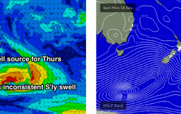
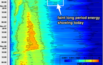
/reports/forecaster-notes/south-east-queensland-northern-new-south-wales/2019/11/18/two-weeks-or-more
thermalben
Monday, 18 November 2019
It’s a pretty depressing surf outlook if you consider just the winds on their own. SE Qld and Far Northern NSW are staring down the barrel (or lack thereof) of more than two weeks of northerly winds, thanks to an entrenched high pressure system in the Tasman Sea, and weak troughiness over Southern NSW. More in the Forecaster Notes.
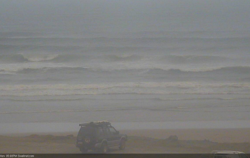
/reports/forecaster-notes/south-east-queensland-northern-new-south-wales/2019/11/15/kinda-hard-get
thermalben
Friday, 15 November 2019
Southerly swells are still strong across Southern NSW today, though gradually easing in size. As such there’s a half to almost one day lag for Northern NSW. More in the Forecaster Notes.
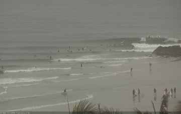
/reports/forecaster-notes/south-east-queensland-northern-new-south-wales/2019/11/13/easing-the-north
thermalben
Wednesday, 13 November 2019
The N’ly windswell is easing rapidly and will be all but gone by Thursday, but we’ve got more southerly swell on the way for the rest of the week. More in the Forecaster Notes.
/reports/forecaster-notes/south-east-queensland-northern-new-south-wales/2019/11/11/wide-range-fun
thermalben
Monday, 11 November 2019
Wednesday morning looks potentially very fun in SE Qld and Far Northern NSW. And there's stacks of S'ly swell on the way (for Northern NSW). More in the Forecaster Notes.
/reports/forecaster-notes/south-east-queensland-northern-new-south-wales/2019/11/08/weekend-o-south
thermalben
Friday, 8 November 2019
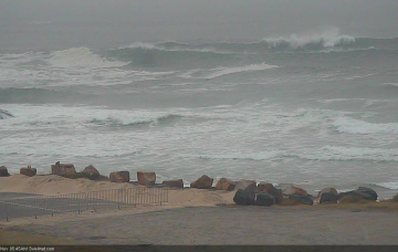
The fetches trailing each front will be considerably off-axis (aligned SW-NE) but they’ll generate some decent size, initially building through Saturday, peaking late afternoon or early Sunday. More in the Forecaster Notes.
/reports/forecaster-notes/south-east-queensland-northern-new-south-wales/2019/11/06/ordinary-period
thermalben
Wednesday, 6 November 2019
Looks like there won’t be much juice left in the tank by Thursday morning. But we have some S'ly swell in store for the weekend. More in the Forecaster Notes.
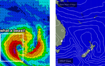
/reports/forecaster-notes/south-east-queensland-northern-new-south-wales/2019/11/04/another-ordinary
thermalben
Monday, 4 November 2019
A small low may form in the central/northern Tasman Sea overnight Tuesday in association with the change, holding southerly winds through our south swell window into Wednesday morning. More in the Forecaster Notes.
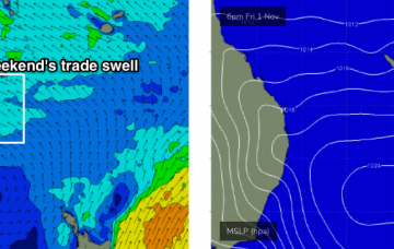
/reports/forecaster-notes/south-east-queensland-northern-new-south-wales/2019/11/01/average-period
thermalben
Friday, 1 November 2019
Persistent troughy conditions along the East Coast next week will bring about a wide range in surface conditions as winds swing around all points of the compass. More in the Forecaster Notes.
/reports/forecaster-notes/south-east-queensland-northern-new-south-wales/2019/10/30/average
thermalben
Wednesday, 30 October 2019
N/NE winds will remain the dominant influence on Northern NSW’s surf prospects for the next five days. Fortunately, we also have a building trade swell on the cards for SE Qld. More in the Forecaster Notes.