/reports/forecaster-notes/south-east-queensland-northern-new-south-wales/2016/08/24/multiple-small
thermalben
Wednesday, 24 August 2016
The synoptics remain complex.
/reports/forecaster-notes/south-east-queensland-northern-new-south-wales/2016/08/22/wednesday-pick
thermalben
Monday, 22 August 2016
All eyes are to the east, as we await this long period E’ly swell generated by a deep mid-latitude low that formed E/NE of New Zealand late last week.
/reports/forecaster-notes/south-east-queensland-northern-new-south-wales/2016/08/19/small-weekend
thermalben
Friday, 19 August 2016
A deep mid-latitude low is intensifying E/NE of New Zealand’s North Island at the moment, and it’s generating a fantastic long period E’ly swell for the South Pacific.
/reports/forecaster-notes/south-east-queensland-northern-new-south-wales/2016/08/17/extended-run
thermalben
Wednesday, 17 August 2016
The trough/low at the backend of the trade belt will continue to provide small waves throughout the rest of the working week, though once again with Far Northern NSW seeing the biggest and best surf.
/reports/forecaster-notes/south-east-queensland-northern-new-south-wales/2016/08/15/building-trade
thermalben
Monday, 15 August 2016
Thursday is the pick of the forecast period, mainly across far Northern NSW and SE Qld beach breaks.
/reports/forecaster-notes/south-east-queensland-northern-new-south-wales/2016/08/12/forget-weekend
thermalben
Friday, 12 August 2016
Unfortunately the outlook for waves this weekend remains grim.
/reports/forecaster-notes/south-east-queensland-northern-new-south-wales/2016/08/10/very-average
thermalben
Wednesday, 10 August 2016
Not much quality surf is expected this weekend.
/reports/forecaster-notes/south-east-queensland-northern-new-south-wales/2016/08/08/not-great
thermalben
Monday, 8 August 2016
After an active period of out of the south, we’ve got a quiet period of waves ahead for most regions.
/reports/forecaster-notes/south-east-queensland-northern-new-south-wales/2016/08/05/fun-weekend-surf
thermalben
Friday, 5 August 2016
We should see some good waves across most coasts this weekend.
/reports/forecaster-notes/south-east-queensland-northern-new-south-wales/2016/08/03/southerly-gales
thermalben
Wednesday, 3 August 2016
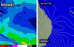
Thursday is all about the strength of the southerly wind: we’re looking at 30-40kts+ at exposed coasts, and 20-30kts elsewhere.

