Haleiwa Challenger Series - Early Forecast
We're approaching that time of year where our attention starts to shift towards the North Pacific Ocean and namely the Hawaiian Island chain.
In October, two typhoons swung north-east past Japan before intensifying in the westerly storm track, generating a couple of large, quality swells for the North Shore. Since then, however, things have quietened down, yet with vital qualifying spots for next year's Championship Tour on the line punters and players alike are wondering if Haleiwa will fire.
Unfortunately, the early outlook isn't too favourable.
Haliewa is a classic reef setup that sits inside Waiaula Bay with Avalanche on the western tip of the bay and Pua'ena Point on the north. Haleiwa's best swells are from the north-west to north-northwest direction as they arrive uninhibited by those two breaks. Any variation away from this direction results in a loss in size.
The waiting period kicks off Saturday week, the 26th of November, but with a travel time of three to four days from storms forming off the Kamchatka Peninsula and Aleutian Islands, we can get a good idea of the outlook - partcularly the first half of the waiting period - by analysing the synoptic charts for next week.
The current forecast shows a moderate-sized mid-period NW swell due early next week, which is too early for the contest, so the activity following this is what we're interested in.
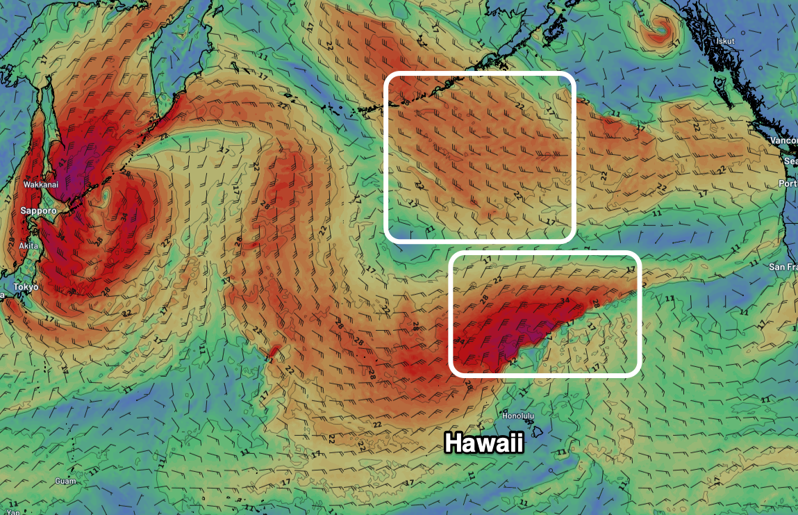
The remnants of the low will move east through the weekend, but a secondary front is forecast to be drawn down from the Bering Sea, behind the low. While any swell generated by this front will be out of the north - i.e not a great direction for Haleiwa - a high pressure ridge looks to fill in quickly from the north-west, sweeping the front quickly away to the east.
As a result mid-period northerly swell is most likely into next Friday/Saturday, blocked slightly by Pua'ena Point. We may see the remnants of the front deepening directly north-east of Hawaii late next week, generating some additional N/NE swell, large across exposed breaks but only moderate in size across Haliewa.

Unfavourable, northerly angled swell producers for Haleiwa (Weatherzone)
Regardless, strong trade-winds from the north-eastern quadrant will create tricky conditions, choppy on take-off but cleaner on the inside bowl - which will accordingly be less bowly with the north swell direction.
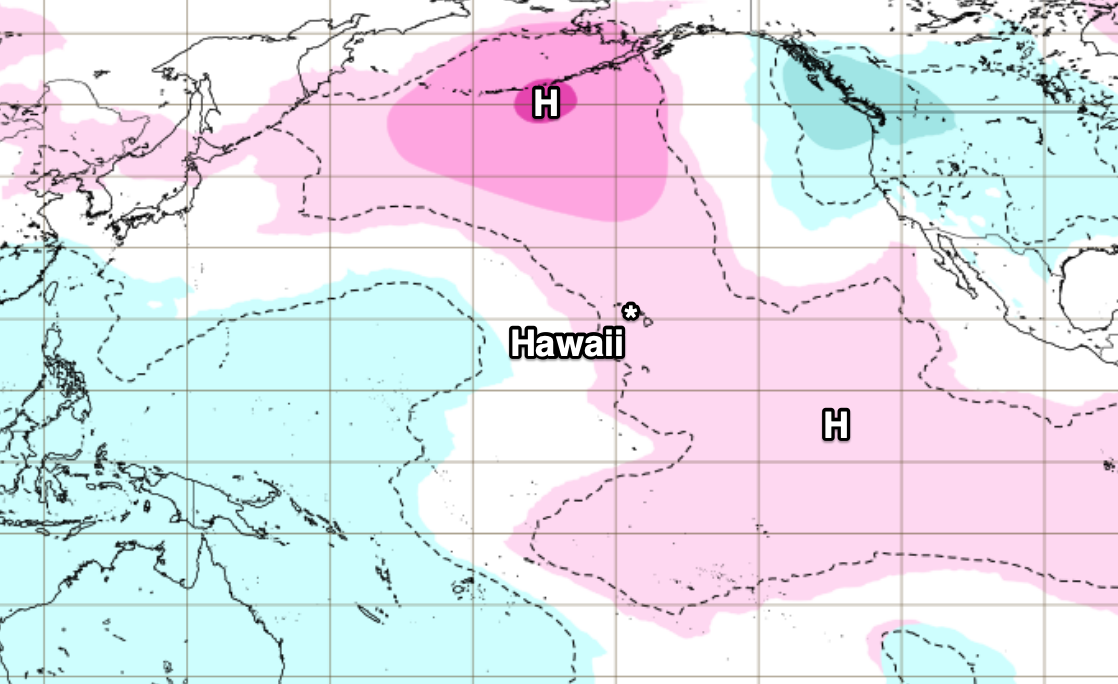
Unfortunately, it looks as if high pressure will dominate the North Pacific through the rest of the waiting period resulting in small, weak waves. Not the outlook we were hoping for.
On this, the reliable European Centre for Medium Range Forecasts (ECMWF) have higher than normal pressure (compared to the climate mean) dominating the prime Hawaiian swell window for a fortnight starting next Monday, adding weight to our early forecast assertions.

Higher than normal pressure forecast across Hawaii's prime swell window for the week 28th Nov to 5th Dec (ECMWF)
Keep an eye on the running comments below for any changes or improvements to the outlook.


Comments
Can't be as bad as what they scored for Sunset a few weeks ago!
Westerly storm track dominated by a high mean average. We know what that means.
I'll be over on the Mediocre Guitar Players page, wake me when LaNina farks orf
I thought the Hawaiian early season swells were needed to clear the sand off the reef & gutters to improve their waves ...?
https://explore.org/livecams/hawaii/hawaii-pipeline-cam
Maybe its an omen, coincidence or indifference,
as last year the WSL "trip of a lifetime" was produced by.... "Inherent Bummer"
https://www.worldsurfleague.com/posts/508632/trip-of-a-lifetime-episode-1
Pipeline is good for windsurfin or foiling atm... if your Kia Lenny
Getting closer - forecast update?
Will have one Thursday.