Fun windows of waves working the winds
Western Australia Surf Forecast by Craig Brokensha (issued Wednesday March 16th)
Best Days: Tomorrow all locations (morning Perth and Mandurah), Friday morning all locations, Saturday protected spots Margs and Mandurah, Sunday morning in the South West, Tuesday morning
Features of the Forecast (tl;dr)
- Moderate to large mid-period SW swell building tomorrow with light SE winds developing through the AM in the South West with weak sea breezes, light E tending fresh S/SW Mandurah and Perth
- Easing SW swell Fri with light S/SE tending SE winds ahead of a fresh W/SW change
- Strong S/SE tending SE winds with a new mid-period SW swell Saturday, easing Sun with SE tending S/SW winds
- Moderate to large SW groundswell building Mon with S tending S/SW winds, easing Tue with morning E/SE-SE winds
Recap
Small to tiny surf with moderate to fresh onshore winds across all locations, stronger in the South West today but with no decent size.
This week and weekend (Mar 17 - 20)
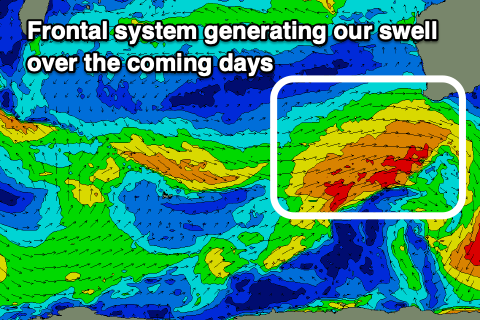
A cold front that's currently clipping the state and linked to tomorrow's SW swell should generate some weak W/SW swell this afternoon across all locations but with those poor, onshore winds.
 Unfortunately there's been a slight downgrade in the strength of the fetch as it projects up and towards us, with it being more elongated.
This is rare only a day before the storm moves through (when the forecast was done Monday) but we're now looking at mid-period SW swell energy to build through tomorrow, easing slowly Friday.
On the upside winds are looking more favourable but first, we should see building surf from 5-6ft tomorrow morning to 6ft+ through the afternoon, easing from a similar size Friday morning.
Mandurah should be 2ft on the sets tomorrow morning, 1-2ft in Perth, building a little into the afternoon and easing from 2ft+ and 2ft respectively Friday morning.
Winds tomorrow look to improve through the morning with a light SE'ly developing across the South West with E'ly winds to the north with sea breezes being relatively weak in the South West, creating fun surf all day.
Friday will be similar with light S/SE tending SE winds in the South West S/SE further north before shifting W/SW and freshening as a trough starts moving in from the west.
The trough will clear quickly to the east but not before leaving strong S/SE tending SE winds into Saturday morning. This will create improving conditions across all locations along with a reinforcing pulse of mid-period SW swell.
This secondary swell still looks a bit under the swell due into the end of the week with a disjointed fetch W/NW gales due to be followed by a flukier fetch of weaker SW winds.
 Size wise 4-6ft surf is due in the South West, 1-2ft in Mandurah and 1-1.5ft across Perth.
Weaker SE winds should be seen on Sunday morning as the swell eases.
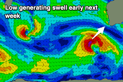
Moving into next week, a new SW groundswell is on the cards for Monday/Tuesday, generated by a strong low firing up south-west of us on the weekend.
The models still diverge on the strength of this system so we'll have to hone in on the specifics Friday but it looks to be in the 6ft range at least for the South West (building Monday), but with S-S/SW winds, easing Tuesday with morning offshores. More on this Friday.


Comments
Haven’t had a surf for 5 weeks on the Mandurah stretch , should I have a sickie Thursday or Friday in your opinion.
Friday.