S/SE swells for the weekend, back to the W/SW next week
Southern Tasmania Forecast (issued Friday 20th June)
Best Days: Saturday through Sunday at exposed spots that handle the northerly
Recap
A good pulse of SW groundswell came in as expected yesterday with 2-3ft waves across Clifton under offshore winds. The swell backed off into the afternoon and today we're left with tiny surf again.
This weekend and Monday (Jun 21 - 23)
The weekend and Monday will consist of small and inconsistent but fun pulses of S/SE groundswell.
The source of this swell was a strong polar low south of New Zealand, with an initial increase due through tomorrow to 1-2ft across Clifton. Exposed locations further down the coast should be slightly bigger.
A temporary drop is then expected into Sunday ahead of a secondary pulse of less consistent and more SE in direction swell. This swell should arrive later in the day and hold into Monday to a similar but inconsistent 1-2ft.
Winds in general are expected to slowly increase from the N'th through the weekend and become strong from the N/NE Monday, limiting options and not favouring those spots picking up the most size.

Next Tuesday onwards (Jun 24 onwards)
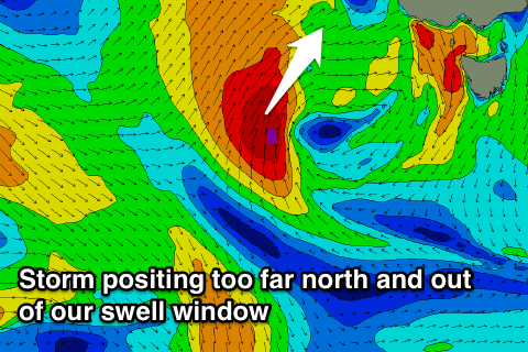
South Australia and Victoria are expected to get slammed by a strong cold outbreak next Tuesday and Wednesday, but unfortunately the system looks to sit too high north for us too see any size at all initially.
The models are still pretty divergent on this system, and the backside of it as it pushes across us should give us more size across Clifton. At this stage it's hard to say how much but at least 2-3ft is likely, but we'll review this again Monday.

