Lighter morning winds with slowly easing surf
South Australian Surf Forecast by Craig Brokensha (issued Friday February 18th)
Best Days: Both coasts tomorrow morning, South Coast Sunday morning, Mid Coast for beginners Sunday morning, South Coast Tuesday and Wednesday mornings
Features of the Forecast (tl;dr)
- Easing mix of moderate to large swells tomorrow with morning E/SE winds on the Mid, E/NE down South ahead of sea breezes
- Mix of moderate sized SW swells Sun with W/NW winds early down South, SE on the Mid, shifting SW-W/SW through the mid-late morning
- Moderate sized mid-period S/SW swell Mon and Tue with S/SE winds on the former, E/NE tending S/SE on the latter
- Easing surf Wed with NE tending SE winds
Recap
Onshore winds but surfable waves for the desperate on the South Coast yesterday, tiny on the Mid Coast.
Today some new swell has kicked Middleton to 3ft with full 1-1.5ft waves on the Mid Coast, both bumpy with moderate to fresh onshore winds.
This weekend and next week (Feb 19 - 25)
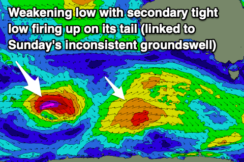
We’re currently seeing a mix of swells building across the state, that being an inconsistent SW groundswell along with a larger, mid-period SW swell that’s due to fill in later this afternoon and evening. Cape du Couedic is now on the rise so it's on the way.
We should see the Mid Coast reaching 1-2ft this afternoon but with average conditions while the South Coast should reach 5-6ft across Middleton and other deep water reefs, easing back slowly through tomorrow from 4-6ft. The Mid should hold 1-2ft all day.
 Unfortunately strengthening S/SW winds associated with the frontal system linked to this afternoon’s larger swell pulse will create poor conditions, with tomorrow offering improving conditions as winds ease and tend E/SE across most locations (likely tending E/NE for a period down South). With the large swell though options will be a little limited as Goolwa will be too big and options around town lumpy and wobbly.
Sunday is looking better as winds shift around to the W/NW down South through the morning with a mix of smaller, reinforcing SW swells. There should be some inconsistent groundswell generated by the stronger, earlier stages of the mid-latitude front generating our large swell and some closer-range swell front a front passing under us tomorrow.
Middleton should come in around 3-4ft with the Mid Coast holding 1-1.5ft, also clean early with a light SE breeze, with bumpy conditions across all locations into the afternoon with freshening W/SW-SW winds.
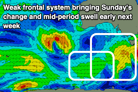
 This increasing onshore flow will be linked to a broad though relatively weak frontal progression moving through, with some mid-period S/SW swell due through Monday and Tuesday to 3ft+ or so, tiny and to 1ft across Middleton.
Winds will be poor and gusty from the S/SE on Monday but improve into Tuesday and Wednesday with a moderate E/NE’ly on the former, better and from the NE on Wednesday as the swell eases from 2-3ft across Middleton.
Longer term it looks like we’ll rever back to unfavourable S/SE winds with no major swells, but more on this Monday. Have a great weekend!

