Tiny run of average surf
Eastern Tasmania Surf Forecast by Craig Brokensha (issued Friday 21st December)
Best Days: No good days
Recap
A small mix of leftover E/SE and NE swells to 2ft yesterday, back to a listless 1-2ft this morning. A small S'ly windswell should be now breaking across the region from a S'ly change pushing up past the coast, though it's alignment wasn't great.
Today’s Forecaster Notes are brought to you by Rip Curl
This weekend and next week (Nov 22 - 28)
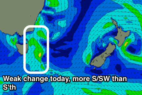
Today's weak S'ly change was more S/SW then ideal and as a result any windswell seen today will back off quickly through tomorrow from 1-2ft max at south magnets, likely smaller.
 Winds look OK for open beaches but not great for south magnets with an early W/SW breeze, tending more SE into the afternoon.
From here there isn't anything of significance on the cards, with tiny amounts of NE windswell likely Tuesday morning, with a similarly weak and junky S'ly windswell Wednesday.
Small to tiny levels of NE windswell are due to continue from Thursday afternoon through next weekend owing to a weak and disjointed fetch of persistent NE winds in our swell window, but more on this Monday. Have a great weekend.

