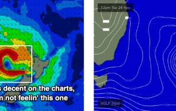
The main focus for the weekend is a stationary ridge of high pressure across the southern Tasman Sea, cradling a deepening trough across the Coral Sea. It's an exciting synoptic chart! More in the Forecaster Notes.
Primary tabs
Now, I know you’re only here to read my thoughts on next week’s possible cyclone swell. But, there’s a whole lot of interesting stuff to talk about prior to then. So, let’s get to it! More in the Forecaster Notes.
Long term maintains a summery troughy pattern across the lower Coral Sea with an extended run of super fun trade swell. More in the Forecaster Notes.
Aside from an early window of light winds on Saturday, we’re looking at strengthening northerlies all weekend. But there are pockets of opportunity before and after this. More in the Forecaster Notes.
There’s a couple of swell sources on the synoptics right now. More in the Forecaster Notes.
You can essentially forget almost the entire weekend. Why? Gusty northerly winds. But, next week has options. More in the Forecaster Notes.
Today’s new SE swell throughout Southern NSW saw solid, well defined sets in the 3ft range, which bodes well for Northern NSW tomorrow. More in the Forecaster Notes.
Model guidance maintains the northerly flow across much of SE Qld through the early morning. At first glance, this would appear to be a negative, but it’s actually a positive. More in the Forecaster Notes.
Saturday looks OK on the surface in a few regions with light variable winds, but we’ll see northerlies elsewhere. Not that it matters much anyway, as there won’t be much surf around. There is however a swell for next week. More in the Forecaster Notes.
Friday’s northerly flow on the Mid North Coast will be the first in four consecutive days of poor, cross-shore conditions. But next week is worth keeping an eye on. More in the Forecaster Notes.

