/reports/forecaster-notes/sydney-hunter-illawarra/2015/01/07/plenty-swell-plenty-wind
thermalben
Wednesday, 7 January 2015
Based on today’s (under) performance I’m going to pull back Thursday’s expected size from the distant trade swell source.
/reports/forecaster-notes/sydney-hunter-illawarra/2015/01/05/persistent-trade-swells-dynamic
thermalben
Monday, 5 January 2015
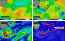
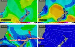
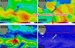
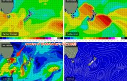
The stationary trade belt across our E/NE swell window is a beauty, and it’s going to be a source of quality surf for quite some time.
/reports/forecaster-notes/sydney-hunter-illawarra/2015/01/02/fun-waves-ahead-long-range-potentially
thermalben
Friday, 2 January 2015
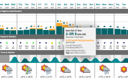
A fun mix of S’ly groundswell and NE windswell is expected all weekend.
/reports/forecaster-notes/sydney-hunter-illawarra/2014/12/31/intermittent-energy-south
thermalben
Wednesday, 31 December 2014
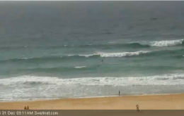
We’ve got some more south swell due over the coming days, generated by the parent low to the front that whipped up today’s pulse.
/reports/forecaster-notes/sydney-hunter-illawarra/2014/12/29/plenty-waves-dodgy-winds
thermalben
Monday, 29 December 2014
Couple of options on the cards this week.
/reports/forecaster-notes/sydney-hunter-illawarra/2014/12/26/reasonable-weekend-waves-ahead
thermalben
Friday, 26 December 2014
Today’s southerly change will whip up a short range south swell that’s due to peak overnight before trending downwards through Saturday.
/reports/forecaster-notes/sydney-hunter-illawarra/2014/12/24/craptacular-christmas
thermalben
Wednesday, 24 December 2014
So Christmas Day, eh? Unfortunately it’s not looking too flash.
/reports/forecaster-notes/sydney-hunter-illawarra/2014/12/22/pulsey-swells-north-east-plus-some-trade
thermalben
Monday, 22 December 2014
Today’s freshening NE winds are kicking up a small local swell that’ll occupy the region through Tuesday.
/reports/forecaster-notes/sydney-hunter-illawarra/2014/12/19/easing-south-then-building-north-east
thermalben
Friday, 19 December 2014
No major changes for the weekend: get in early Saturday as we’re looking at diminishing wave heights across both days.
/reports/forecaster-notes/sydney-hunter-illawarra/2014/12/17/plenty-swell-store
thermalben
Wednesday, 17 December 2014
However, this fetch is both slipping southwards (not good for us) in addition to a counter-clockwise rotation of the fetch alignment (also not good for us), which reduces the surf potential from what would have otherwise been an excellent swell producer.

