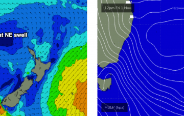
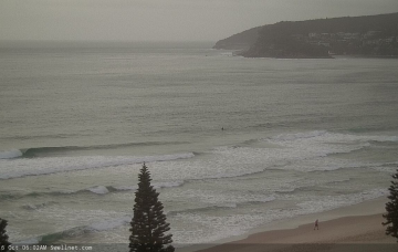
Essentially, we’ve got a series of overlapping southerly swells on target for Southern NSW. And some NE swell at the end of the week. More in the Forecaster Notes.
Primary tabs
/reports/forecaster-notes/sydney-hunter-illawarra/2019/10/28/patchy-conditions-though-plenty-swell
thermalben
Monday, 28 October 2019
/reports/forecaster-notes/sydney-hunter-illawarra/2019/10/25/episodic-southerly-swells-dominate-next
thermalben
Friday, 25 October 2019
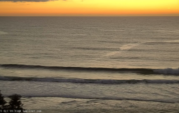
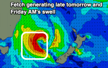
Sunday’s south swell will be related to a small fetch associated a much broader, more complex series of polar lows and fronts further south. More in the Forecaster Notes.
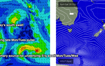
/reports/forecaster-notes/sydney-hunter-illawarra/2019/10/23/flukey-swell-sources-galore
thermalben
Wednesday, 23 October 2019
Another series of poorly aligned fronts are approaching the southern tip of New Zealand from the south-west, and although the swell they’re generating will be aimed into the eastern Tasman Sea and South Pacific, we’ll see a small spread back into Southern NSW. More in the Forecaster Notes.
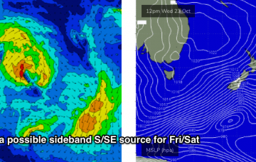
/reports/forecaster-notes/sydney-hunter-illawarra/2019/10/21/pulsey-southerly-swells-most-the-week
thermalben
Monday, 21 October 2019
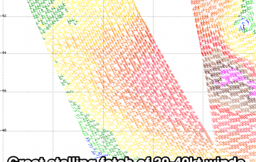
The models really aren’t handling this current southerly swell, nor any of the upcoming energy due throughout the week. More in the Forecaster Notes.
/reports/forecaster-notes/sydney-hunter-illawarra/2019/10/18/fun-round-small-pulsey-swells-ahead
thermalben
Friday, 18 October 2019
So, we’ve got a weekend of two halves. More in the Forecaster Notes.
/reports/forecaster-notes/sydney-hunter-illawarra/2019/10/16/patchy-period-ahead-therell-be-ok-waves
thermalben
Wednesday, 16 October 2019
The weekend’s northern Tasman Low that set up camp off New Zealand’s north-west tip earlier this week didn’t quite perform as well as model guidance indicated on Monday. More in the Forecaster Notes.
/reports/forecaster-notes/sydney-hunter-illawarra/2019/10/14/pockets-nice-waves-ahead
thermalben
Monday, 14 October 2019
A strong E/SE fetch will develop off the west coast of the North Island today, holding into tomorrow morning, and this will kick up a nice E’ly tending E/SE swell for Southern NSW. More in the Forecaster Notes.

/reports/forecaster-notes/sydney-hunter-illawarra/2019/10/11/large-se-groundswell-inbound
Craig
Friday, 11 October 2019
Our current run of SE swell will continue into the weekend, becoming larger and more powerful, easing into next week. Improving winds from Sunday.
/reports/forecaster-notes/sydney-hunter-illawarra/2019/10/09/great-run-sse-se-swell
Craig
Wednesday, 9 October 2019
Lots of swell inbound with workable winds for the most part.
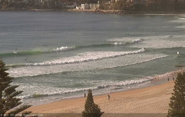
/reports/forecaster-notes/sydney-hunter-illawarra/2019/10/07/some-great-swells-ahead-likely-spoiled
thermalben
Monday, 7 October 2019
The main synoptic feature this week is a vigorous front that’ll reach SA/Vic this evening, before crossing the Southern NSW coast on Tuesday. More in the Forecaster Notes.