No shortage of swell sources lining up for the forecast period, across almost every part of our swell window. More in the Forecaster Notes.
Primary tabs
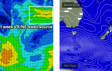
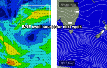
/reports/forecaster-notes/sydney-hunter-illawarra/2020/02/28/strong-the-south-then-punchy-the-south
thermalben
Friday, 28 February 2020
/reports/forecaster-notes/sydney-hunter-illawarra/2020/02/26/aint-bad-time-be-looking-waves-in
thermalben
Wednesday, 26 February 2020
Stacks of swell ahead as we enter a classic autumn synoptic pattern. More in the Forecaster Notes.
/reports/forecaster-notes/sydney-hunter-illawarra/2020/02/24/stacks-flukey-swells-the-boil-good
thermalben
Monday, 24 February 2020
We’ve got a couple of swell sources for the next few days. Next week looks pretty exciting too. More in the Forecaster Notes.
/reports/forecaster-notes/sydney-hunter-illawarra/2020/02/21/reasonable-weekend-waves-reasonable-long
thermalben
Friday, 21 February 2020
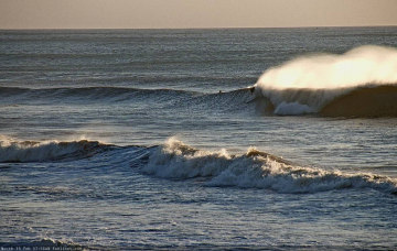
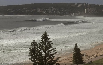
We’ve got a few OK waves in store for the weekend but it won’t be anything amazing. Plenty of interesting options lining up for the long term though. More in the Forecaster Notes.
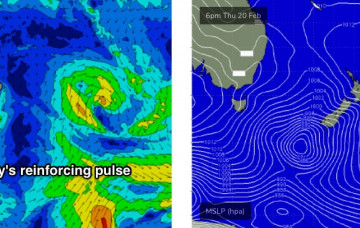
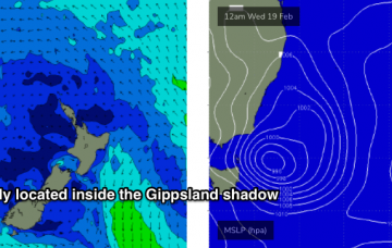
/reports/forecaster-notes/sydney-hunter-illawarra/2020/02/19/good-outlook-though-nowhere-near-good
thermalben
Wednesday, 19 February 2020
There's still plenty of fun waves to finish the working week. More in the Forecaster Notes.
/reports/forecaster-notes/sydney-hunter-illawarra/2020/02/17/diverse-range-surf-options-the-coming
thermalben
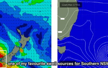
Monday, 17 February 2020
We’ve got some more cracking waves on the way for the coming days. But you’ll have to work around the winds. More in the Forecaster Notes.
/reports/forecaster-notes/sydney-hunter-illawarra/2020/02/14/large-steadily-easing-swells-light-winds
thermalben
Friday, 14 February 2020
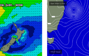
As for size, we need to be a little careful with our expectations, because today has shown that these kinds of long period events can be steered efficiently into some locations, but less efficiently into others. More in the Forecaster Notes.
/reports/forecaster-notes/sydney-hunter-illawarra/2020/02/12/strong-cyclone-swell-southern-nsw
thermalben
Wednesday, 12 February 2020
TC Uesi is a great looking system, and we’re going to see some excellent waves over the coming days. Where, when and how much? More in the Forecaster Notes. Oh, and there's a strong SE groundswell due next week too!
/reports/forecaster-notes/sydney-hunter-illawarra/2020/02/10/great-week-waves-ahead-sizeable-weekend
thermalben
Monday, 10 February 2020
There’s a couple of things I really like about TC Uesi, but a few things I don’t. More in the Forecaster Notes.
/reports/forecaster-notes/sydney-hunter-illawarra/2020/02/07/todays-forecast-brought-you-the-letters
thermalben
Friday, 7 February 2020
We’re looking at small lows developing along the trough line - one of which may evolve into an ECL - and these will display much stronger winds, and thus will generate larger waves heights across narrow regions. More in the Forecaster Notes.