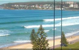
Today’s strong southerly swell will ease rapidly overnight, and conditions should be clean for the early session with light offshore winds.
Primary tabs
/reports/forecaster-notes/sydney-hunter-illawarra/2016/07/29/endless-south-swells-foreseeable-future
thermalben
Friday, 29 July 2016
/reports/forecaster-notes/sydney-hunter-illawarra/2016/07/27/back-back-sly-groundswell-pulses
Guy Dixon
Wednesday, 27 July 2016
Not shortage of S'ly swell to come with good offshore breezes.

/reports/forecaster-notes/sydney-hunter-illawarra/2016/07/25/plenty-south-swell-week-looking-very-big
thermalben
Monday, 25 July 2016
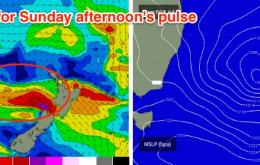
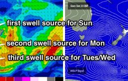
The rest of the week is quite complex, with a series of back-to-back frontal systems expected to generate varying degrees of south swell.
/reports/forecaster-notes/sydney-hunter-illawarra/2016/07/22/plenty-strong-south-swell-sunday-onwards
thermalben
Friday, 22 July 2016
The weekend’s on track to deliver two completely different days of waves, but with fresh offshore winds the entire time.
/reports/forecaster-notes/sydney-hunter-illawarra/2016/07/20/small-pulses-end-week-more-size-sunday
Guy Dixon
Wednesday, 20 July 2016
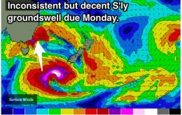
A workable little E/SE swell is on the cards for Thursday accomapnied by modest S'ly pulses. Sunday and Monday should see more substantial southerly swell.
/reports/forecaster-notes/sydney-hunter-illawarra/2016/07/18/small-pulses-through-week-becoming-big
Guy Dixon
Monday, 18 July 2016
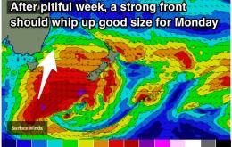
Small southerly pulses, with the next solid swell due early next week.
/reports/forecaster-notes/sydney-hunter-illawarra/2016/07/15/fun-south-swell-saturday-easing-sunday
thermalben
Friday, 15 July 2016
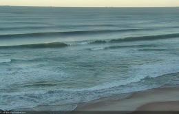
We’ve got one final push of south swell across the Southern NSW coast this afternoon, and it’ll provide some great waves across all regions through into Saturday morning.
/reports/forecaster-notes/sydney-hunter-illawarra/2016/07/13/solid-sly-swell-mixed-smaller-ely-energy
Guy Dixon
Wednesday, 13 July 2016
Plenty of options for the end of the week and weekend with a mix of E'ly and S'ly energy.
/reports/forecaster-notes/sydney-hunter-illawarra/2016/07/11/plenty-good-options-come-mix-ely-and-sly
Guy Dixon
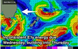
Monday, 11 July 2016
Offshore breezes and increasing options from Wednesday. Plenty of waves right through until Sunday.
/reports/forecaster-notes/sydney-hunter-illawarra/2016/07/08/great-weekend-se-swell-strong-sly-swell
thermalben
Friday, 8 July 2016
The weekend’s looking really good for surfing.