Fun south swell Saturday, easing on Sunday; small renewal of S'ly swell Wednesday
Sydney, Hunter and Illawarra Surf Forecast Surf Forecast by Ben Matson (issued Friday 15th July)
Best Days: Sat/Sun: strong but easing S'ly swell with mainly good winds. Wed: small fun south swell at swell magnets.
Recap: Quality S’ly swell building Thursday and holding today with 4-5ft sets at south facing beaches, and clean conditions under an offshore breeze. Another pulse of S'ly swell is pushing along the Southern NSW coast this afternoon.

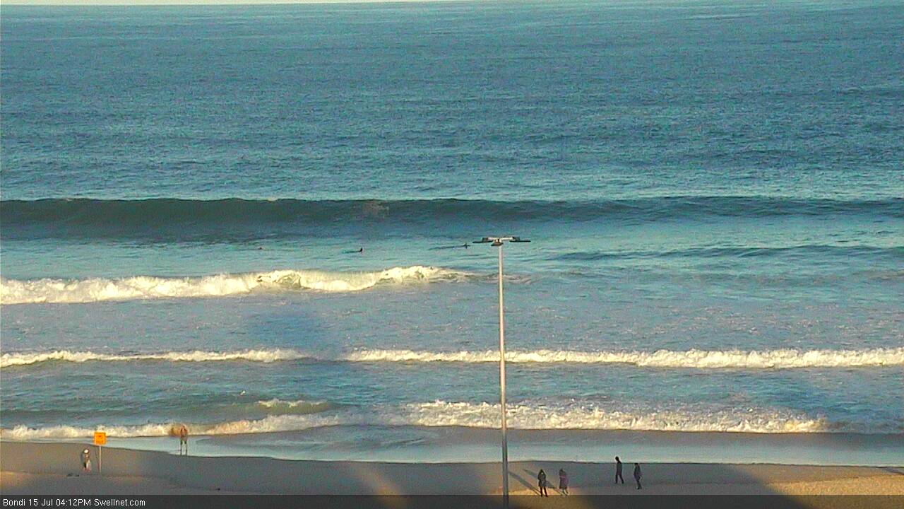
Late afternoon lines of southerly swell at Bondi Beach
This weekend (Saturday July 16th - Sunday July 17th)
We’ve got one final push of south swell across the Southern NSW coast this afternoon from the recent frontal passage through the Southern Tasman, and it’ll provide some great waves across all regions through into Saturday morning.
However the trend will be downwards across the weekend so you’ll have to make the most of the early morning session on Saturday.
A weak ridge of high pressure will direct light to moderate southerly winds across the region on Saturday but local terrestrial influences should steer this around to the west in most regions early morning. However be aware that moderate cross-shore winds could develop at some point throughout the day. Light variable winds are expected on Sunday with clean conditions just about everywhere.
South facing beaches will pick up the most size both days, with occasional 4-5ft sets on Saturday morning easing to 3-4ft during the day, then further from 2-3ft+ to 2ft on Sunday, becoming less consistent as the weekend wears on.
Beaches not open to the south will be smaller in size and southern corners will be very small, due to the swell direction. However the Hunter region should see another foot or more on top of these size estimates.
Next week (Monday July 18th onwards)
A series of poorly aligned fronts through the eastern Tasman Sea over the weekend won’t generate much new south swell for us. We may see some minor sideband energy clip the coast on Monday and Tuesday but no real size is expected from it. As such, expect small leftover energy both days with mainly light variable winds.
A blocking high pressure system on Sunday and Monday will steer the storm track away from our swell window before another advancing Southern Ocean front enters the lower Tasman Sea on Tuesday morning. This system will last only a brief period of time within our swell window, so consequently we’re looking at a temporary flush of small south swell late Tuesday (Far Southern NSW) and throughout Wednesday (Sydney/Hunter coasts) that may produce a few 2-3ft+ sets at south facing beaches (and slightly bigger in the Hunter). I'm not especially excited by this swell though, so don't rearrange your diary for anything just yet.
Other than that, the storm track looks unfavourable for us for the long term. Model guidance is suggesting a developing trough off the coast on Wednesday but it probably won’t be a swell producer for us, so after Wednesday’s brief south swell we could be looking at a few days of small residual energy only suitable for exposed beaches.
Have a great weekend, hope you get some good waves from that south swell! See you Monday.


Comments
looks like its time to hit the gym & dojo
Huh? Not yet mate. Weekend of good waves ahead.
Still plenty of size in Sydney. Bondi picking up the odd 3ft+ bomb.