Fun easing surf tomorrow then average until late in the weekend
Western Australia Surf Forecast by Craig Brokensha (issued Monday 14th January)
Best Days: Tomorrow morning all locations, keen surfers South West magnets Saturday morning, Sunday in the South West as the swell builds, protected spots next Monday morning
Recap
A mix of new swells for Saturday with clean conditions across the South West and fun options on the magnets, while Sunday saw a steep increase in new SW groundswell but with average onshore winds.
The swell has held well in across all regions today, with a period of favourable winds which have now gone onshore across all locations.
Today’s Forecaster Notes are brought to you by Rip Curl
This week and weekend (Jan 15 – 20)
 The swell increase seen through yesterday was out of the SW and today we've got some better aligned though slightly lower-period W/SW swell filling in.
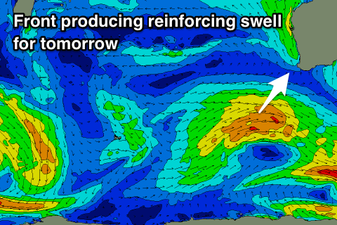
We should see the W/SW energy easing through tomorrow, though a reinforcing SW swell will slow this trend, produced by a weak front that's currently south-west of us.
Margs should offer 4-6ft sets, with 2ft+ waves in Mandurah and 2ft sets in Perth, easing later in the day and smaller through Wednesday.
Winds will be generally out of the S/SE tomorrow morning, if not tending SE for periods before sea breezes kick in. Therefore slightly protected breaks will be the go through the morning.
Wednesday looks average with winds more S/SE than SE and with the easing swell, options will be limited. Thursday is definitely a lay day with a further drop in swell and onshore S/SW tending SW breeze.
 The surf is expected to continue dropping away into the weekend, though a background long-period W/SW groundswell signal should keep the South West ticking over. Winds will be great each morning and light offshore out of the E.
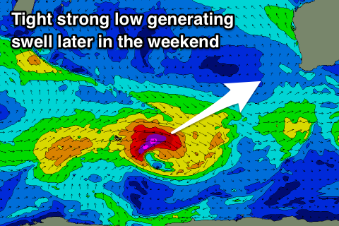
A new moderate to large sized long-period SW groundswell is due to build Sunday and likely peak later in the day/evening, produced by an intense but tight low forming around the Heard Island region.
Core wind speeds should reach severe-gale to storm-force with the swell building to 6ft+ across the South West, 2ft to maybe 3ft in Mandurah and an inconsistent 2ft in Perth. Unfortunately a trough moving in from the west Sunday will likely leave S/SE winds on Monday morning as the swell slowly eases, but more on this Wednesday.

