Poor end to the week, not much better on the weekend
Western Australia Surf Forecast by Craig Brokensha (issued Wednesday 6th July)
Best Days: Dawn around Margs and Perth tomorrow for desperate surfers, protected spots for those same desperate surfers over the weekend, swell magnets in the South West Monday, northern corners Tuesday
Recap
Fun clean waves across swell magnets in the South West yesterday morning, with tiny waves to the north.
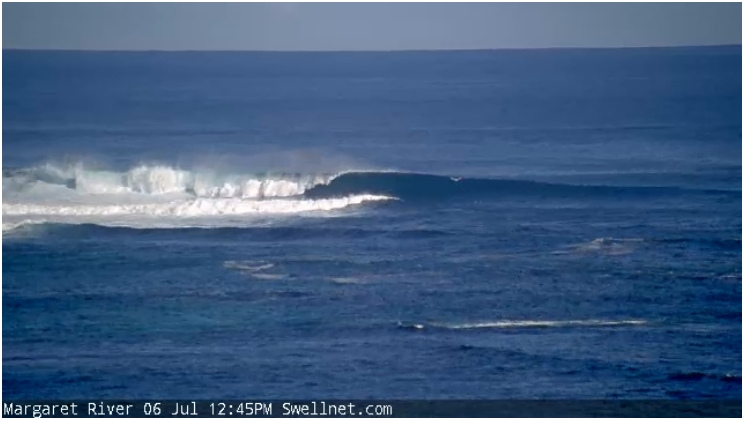
This morning the surf was a little slow and clean with 4ft waves across the South West and 1ft surf to the north, but a strong new SW groundswell has since kicked with clean 5-6ft sets across swell magnets and 1-1.5ft waves to the north.

This week and weekend (Jul 7 - 10)
Make the most of today's kick in groundswell and favourable winds, as the surf will ease through tomorrow and besides an early NE'ly down in the South West, winds will tend N/NW mid-morning and strengthen as a strong frontal system approaches from the west. Perth will see winds remaining offshore longer but with fading 1-1.5ft sets.
The large stormy swell due into the end of the week and weekend has changed a little, with Friday seeing the most size and weaker amounts of S/SW swell into Saturday and Sunday.
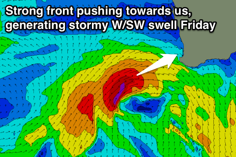
Currently a strengthening and small front is projecting towards us with a fetch of gale to severe-gale W/SW-SW winds being generated.
 This will produce a large stormy increase in W/SW swell, building through the day to 8-10ft in the South West and 3ft through Perth but with strong W/NW tending SW winds.
The front itself is due to weaken and move across us later in the day Friday, swinging winds S/SE after dark.
This will also result in a drop in size ahead of a building acute S'ly swell from a broad fetch of strong S/SW winds off our coast Friday evening and Saturday, retracting slowly east Sunday and Monday.
Easing 6-8ft sets out of the W/SW are due Saturday with the S/SW swell coming in at 6ft+, easing back through Sunday.
Perth should see 2-3ft waves Saturday, easing back from a similar size Sunday morning. Strong S'ly tending S/SW winds will create generally poor conditions Saturday, persisting from the S/SW Sunday.
Next week onwards (Jul 11 onwards)
By the time winds swing offshore from the SE Monday morning, there'll be no real size left with a fading weak mid-period S/SW swell.
A new stronger period S/SW groundswell is due Tuesday from a small polar low skirting the polar shelf and then projecting north up towards us very late in our swell window. A fetch of S/SW gales should produce 5-6ft+ waves across the South West Tuesday morning at its peak, easing into the afternoon. Perth will struggle to see 1-1.5ft sets.
Fresh N/NE winds will also limit surfing options.
The rest of the week isn't looking too significant with easing surf and strengthening N'ly winds Wednesday, onshore and with a building W'ly swell Thursday.
Some larger W/SW groundswell is on the cards for late week/Saturday and with favourable winds, but more on this Friday.

