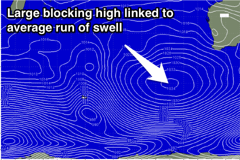
Small surf to continue with generally favourable winds
Western Australia Surf Forecast by Craig Brokensha (issued Wednesday April 1st)
Best Days: Exposed breaks Thursday and Friday morning, protected spots around Margs Sunday morning, exposed breaks from Tuesday
Recap
Small waves in the South West yesterday with an early variable breeze before onshores kicked in, tiny up around Perth.
Today a mix of swells has kept wave heights up around 3-4ft across the South West with improving E'ly winds, while Perth is tiny.
This week (Apr 2 - 3)
Today's small kick in SW groundswell across the South West should ease off into tomorrow and further Friday. Exposed breaks are still due to be around 3-4ft tomorrow, backing off from 3ft at swell magnets Friday morning. Perth will become near flat.
Conditions should be great across exposed breaks with an E/NE offshore tomorrow morning (tending variable into the afternoon) and then similar E/NE winds Friday morning ahead of afternoon sea breezes.
 This weekend onwards (Apr 4 onwards)
The weekend should see some new SW groundswell filling in across the state but it will only really impact the South West and fail to provide any decent size across Perth.
The source of this swell is a polar front that's currently south-east of Heard Island, generating a fetch of SW gales on the edge of our swell window today.
The swell should build through Saturday, reaching 3-5ft at exposed breaks into the mid-late afternoon (3-4ft early) with Perth not seeing any real size until late to 1ft+. Sunday morning will then see the swell easing from 3-4ft and 1ft+ respectively.
Winds on Saturday will be average and from the S/SE across Margs, with better but strong SE winds on Sunday, favouring protected breaks.
Winds will remain strong but better from the E/SE as the swell steadies around 3ft+ across exposed breaks.
A slight lift in SW swell is due Tuesday followed by a secondary S/SW groundswell Wednesday from continued polar frontal activity but only to 3-4ft+ Tuesday morning with Wednesday's being a touch smaller.
Winds should ease and remain offshore from the E/NE Tuesday and Wednesday morning.
Longer term there's nothing too major on the cards until the week starting the 13th when we should see some better frontal activity firing up and into us. More on this Friday though.

