Great waves developing across the beaches
Victoria Forecast by Craig Brokensha (issued Monday 27th November)
Best Days: Protected spots east of Melbourne tomorrow morning, exposed beaches Wednesday morning and Thursday morning
Recap
Small workable waves across magnets on the weekend, best on the Mornington Peninsula with the most size and variable winds.
This morning the swell has bottomed out along with an onshore change, but we should see some new SW groundswell filling in through the mid-late afternoon. Cape Sorell is on the rise, but conditions will remain poor with a S'ly wind.

Today’s Forecaster Notes are brought to you by Rip Curl
This week and weekend (Nov 28 – Dec 3)
This afternoon's increase in SW groundswell was generated by a strong polar low firing up south-west of WA late last week, and we should see it building to an inconsistent 3ft across swell magnets on the Surf Coast late in the day, and 4-6ft on the Mornington Peninsula.
We'll see the swell easing through tomorrow, back from a similar 3ft on the sets across Surf Coast swell magnets, and 4-5ft+ on the Mornington Peninsula. Winds are now looking better for selected locations east of Melbourne tomorrow morning with a light to moderate E'ly breeze, strengthening from the E/SE through the day.
Wednesday is looking better again as winds swing more offshore from the NE through the morning along with a reinforcing pulse of SW swell, from a secondary weaker front moving in behind the initial low.
We should see the Surf Coast hanging in at 2ft+ during the morning, with 3-5ft sets on the Mornington Peninsula, easing through the day as E/SE sea breezes kick in early-mid afternoon.
 Moving into the end of the week, the swell will really drop away, with the Mornington Peninsula the best option Thursday with offshore N/NE winds and easing 2-3ft sets. Friday will be tiny and with increasing onshore winds as a deepening surface trough moves in from the west.
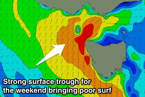
This surface trough will stall in our region and continue to strengthen, with poor levels of S'ly windswell on the cards with strong onshore winds due over the weekend.
There's no new groundswell due until early the following week, but with the dynamic nature of the surface trough for the weekend, we'll have to look at this closer Wednesday.


Comments
Nice peaks at 13th Beach before those winds perk up.
