Large powerful W/SW groundswell tomorrow, pumping Wednesday
Victoria Forecast by Craig Brokensha (issued Monday 18th September)
Best Days: Surf Coast Tuesday morning, Surf Coast Wednesday, all locations Thursday morning, Friday and Saturday
Recap
Poor conditions Saturday with a building S/SW groundswell and windswell, cleaning right up into yesterday with offshore winds and excellent easing surf from 3-4ft on the Surf Coast and the 6ft+ range east of Melbourne as conditions really improved late morning.
The swell was back to the small to tiny range and strong N'ly winds aren't helping the cause.
This week and weekend (Sep 19 – 24)
 Today's strong N'ly winds are linked to a strong approaching front, spawning off the vigorous low pressure system that formed over the weekend.
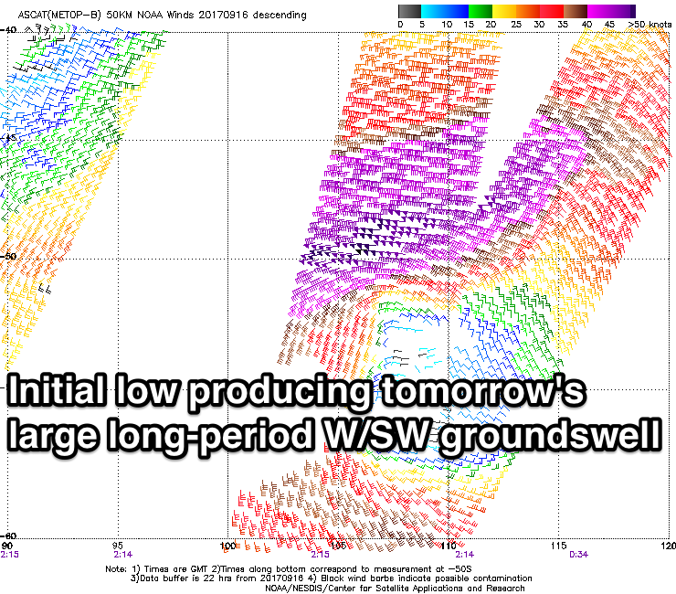
This low has generated an amazing slow moving fetch of severe-gale to storm-force W/SW winds in our western swell window, with similar strength winds continuing to be generated last night more in our south-western swell window.
What we should see is a large long-period W/SW groundswell arriving later today and peaking tomorrow morning to 6ft across the Surf Coast on the sets, with occasionally sets up to 8ft at magnets. The Mornington Peninsula will be large and in the 10ft range.
There'll also be some local W/SW windswell from the front pushing in and across us this afternoon and evening.
Winds look favourable for protected spots during the morning and out of the W/NW, but a shift to the W/SW is mid-late morning.
The swell should ease into the afternoon slightly, but come Wednesday a reinforcing pulse of SW groundswell is due, generated by the strong winds around the low last night and early this morning.
 The Surf Coast should still see 4-5ft+ sets with 6-8ft waves on the Mornington Peninsula, easing slowly through the day. Conditions will be excellent with a moderate N/NW breeze due all day.
Come Thursday we'll be back to the small stuff as N/NW winds persist, possible giving into a late afternoon W/SW change. The Mornington Peninsula should see straight N'ly winds through the morning and fun sets easing from 4ft.
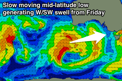
A new W/SW swell is expected on Friday, easing very slowly Saturday owing to a slow moving and strong mid-latitude low drifting in from the south-west of WA.
We'll see this low generating various fetches of strong to gale-force W/SW winds through our western swell window from today through until Wednesday resulting in a prolonged swell event.
The first stage of the swell will be quite west, edging slightly more towards south-west during its later stages.
 An arrival is expected overnight Thursday with Friday seeing 3ft sets on the Surf Coast and 5-6ft waves on the Mornington Peninsula, coming in a similar size Saturday morning before easing into the afternoon and further Sunday morning.
Conditions look great for all locations Friday with light local offshore winds, and afternoon sea breezes, with N/NE tending W/NW winds Saturday.
Another mid-latitude low approaching Sunday will bring stronger NW winds and possibly some building westerly windswell, but more on this Wednesday.


Comments
Another cracking outlook..... been an impressive month or so....
Epic spring break