Tiny to small run of surf, most active early next week
Southern Tasmanian Forecast by Craig Brokensha (issued Wednesday December 4th)
Best Days: Monday, early Tuesday
Features of the Forecast (tl;dr)
- Tiny W/SW swell this afternoon, fading tomorrow with light N/NW tending S/SW winds mid-AM
- Tiny W/SW swell building Sat PM, easing Sun
- N/NE tending fresh S/SE winds Sat, strengthening W-W/NW tending W/SW on Sun
- Building W/SW swell Sun PM, holding Mon, easing Tue
- N/NW tending W/NW winds Mon, N/NW tending S winds mid-AM Tue
Recap
Tiny surf yesterday with early lump ironing itself out during the morning, clean again this morning and also hanging in at 0.5-1ft.
This week and next (Dec 5 - 13)
A tiny increase in swell due this afternoon hasn’t really shown that well, with it expected to ease into tomorrow under an early, light offshore before a trough brings a shallow change mid-morning, fresher into the afternoon. Expect fading sets to 1ft+ or so.
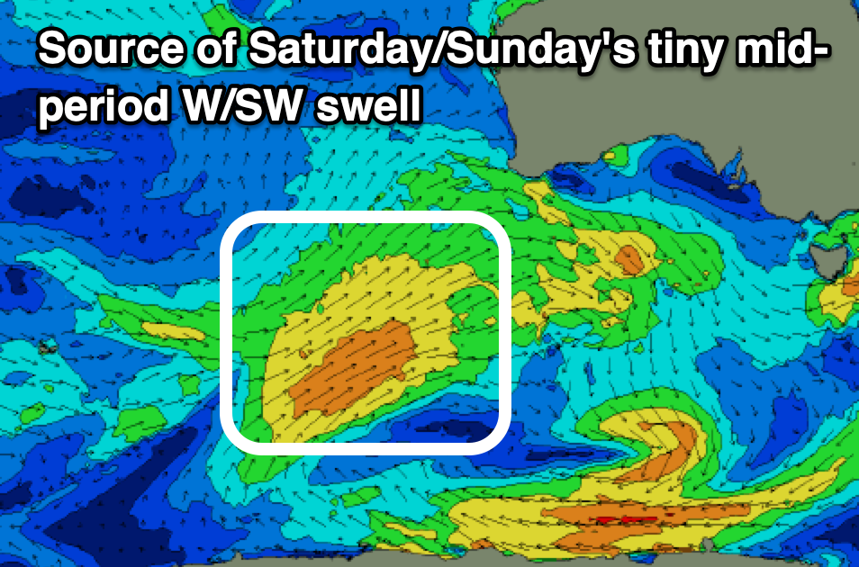
Tiny surf will persist Friday and Saturday morning, but into Saturday afternoon and Sunday morning, a small to tiny increase in mid-period W/SW swell is due.

The source is a healthy fetch of strong W/SW winds south of Western Australia today and this should provide 1-1.5ft sets.
A N/NE wind will shift S/SE into Saturday afternoon with Sunday seeing gusty W-W/NW winds, shifting strong W/SW through the day.
This will be as the remnants of the swell generating front moves in and under us, with some localised W/SW swell due to build through the day to 2ft+, holding this size Monday and easing Tuesday.
Local winds should be great and N/NW tending fresh W/NW on Monday with dawn N/NW winds ahead of a mid-morning S/SW change. We’ll confirm this on Friday.

