Poor outlook holds
Southern Tasmanian Forecast by Craig Brokensha (issued Friday October 20th)
Best Days: No good days
Features of the Forecast (tl;dr)
- Strong SW winds tomorrow with a localised windswell
- Tiny W/SW swell Sun with SW winds
- Tiny W/SW swell Mon/Tue
- N tending strong E/NE winds Mon, strong N/NE tending variable winds Tue
- Swell potential mid-late next week
Recap
Our tiny W/SW groundswell was just that with 1ft waves seen yesterday with light, variable winds, similar this morning but lumpy ahead of an onshore change.
This weekend and next week (Oct 21 - 25)
The outlook for the region remains poor this weekend and early next week with no swells of size expected.
A trough will bring a strong SW tending S/SW change tomorrow, weaker but lingering out of the SW Sunday and with tiny amounts of swell.
A tiny W/SW swell is due Monday, generated by a distant frontal progression that’s currently south-west of Western Australia. 1ft waves may be seen Monday and Tuesday along with a morning offshore Monday ahead of strong E/NE sea breezes, then strong N/NE winds Tuesday morning, tending variable.

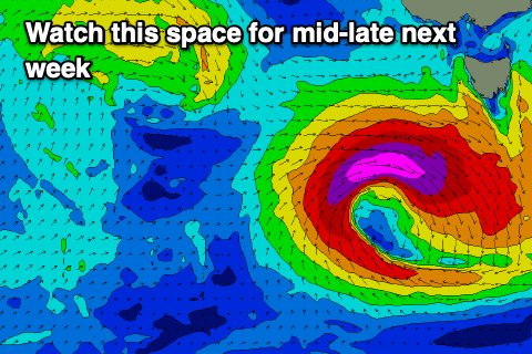
From the middle to end of next week we’ve got a more dynamic outlook with a deepening trough come low likely to generate an increase in swell. The models diverge on the strength and intensity of this system along with the local winds so you’ll have to check back on Monday for an update on the swell potential.
At this stage it looks like the peak of energy might be paired with onshore winds. More on this Monday, and in the meantime try the East Coast notes for more options.

