Easing surf with a tiny weekend
Southern Tasmanian Forecast by Craig Brokensha (issued Wednesday October 2nd)
Best Days: Today, tomorrow morning
Features of the Forecast (tl;dr)
- Easing surf tomorrow with N tending stronger E/NE winds
- Tiny Fri with strong N/NE tending E/NE winds
- Small E/SE swell for Sun PM and Mon AM
- Windy, onshore surf building Mon, easing Tue with W/NW tending strong SW winds on Mon, W/SW Tue
Recap
Yesterday started tiny and windy but some new close-range swell built through the day along with strong cross-shore winds.
This has cleaned up this morning and is easing from 2-3ft across Clifton.
This week and next (Oct 3 - 11)
The swell generating frontal system linked to today’s swell has already moved off to the east and with this we’re expecting a steady decline in swell, dropping from 2ft tomorrow and then tiny on Friday.
A N’ly offshore will shift E/NE and strengthen tomorrow afternoon with Friday seeing strong N/NE tending NE winds.

Unfortunately the weekend isn’t expected to offer any surf besides a small E/SE swell for Sunday/Monday across exposed locations down the South Arm. Try the East Coast Forecaster notes for more options.
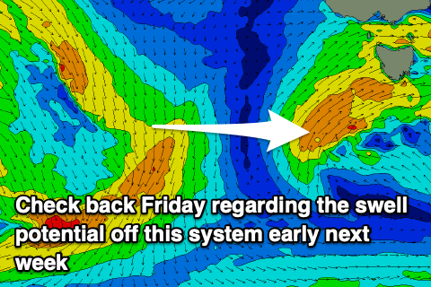
We then look at a strengthening low directly under us on Monday, though the models diverge on the strength and intensity of this system.
EC has it much weaker with an onshore change and weak, short lived windswell on the cards. GFS has it stronger, generating a moderate + sized pulse of S/SW swell for Monday afternoon with onshore winds, easing Tuesday under a persistent onshore flow.
WIth this divergence we’ll have to reassess the swell potential and local winds again on Friday, though EC will likely win the battle.

