Slight upgrade in tomorrow's swell
Southern Tasmania Surf Forecast by Craig Brokensha (issued Friday 22nd April)
Best Days: Saturday, Monday, Tuesday morning
Recap
Wednesday afternoon's kick in swell eased back steadily from 2ft+ yesterday morning, tiny today.
This weekend and week (Apr 25 – May 1)
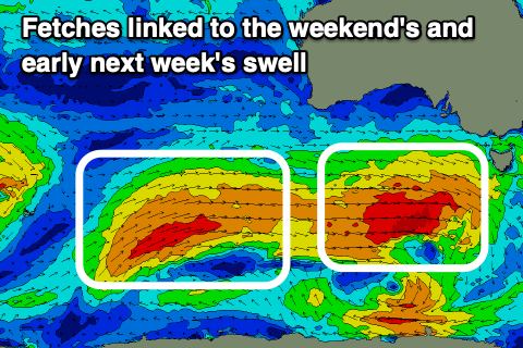
Right now, a strengthening cold front directly west-southwest of us is generating a fetch of gale to severe-gale W/SW winds.
This is a touch stronger and better aligned than forecast on Wednesday and with this we'll see swell more to a consistent 2ft across Clifton tomorrow, easing back to 1ft to maybe 2ft Sunday morning.
 A fresh pulse of W/SW swell is expected Sunday afternoon though as a cold front pushes in and under us, generating 1-2ft of weaker swell, holding Monday to a similar size (against the model forecasts) as yet another strong but unfavourably aimed W/NW fetches moves through.
Coming back to the winds tomorrow and they look great and fresh N'ly, easing into the afternoon with Sunday seeing a W'ly change just after dawn, W/SW into the afternoon.
Monday should then offer clean conditions again with a N/NW tending W/NW breeze.
The swell is due to start easing Tuesday from 1-2ft and from here we keep an eye on a strong and tricky mid-latitude low that's due to form across the south-east of the country. At this stage the low looks to aim all its energy into South Australia and Victoria, but once it drifts further east we're likely to see a further intensification through our swell window. More on this Monday though. Have a great weekend!

