Plenty more swell to come
Southern Tasmania Surf Forecast by Craig Brokensha (issued Wednesday 15th May)
Best Days: Every day this period
Recap
A reinforcing W/SW swell to 2-3ft across Clifton, while today another new mix of W/SW and SW swell have kept the surf up around 3ft with favourable winds.
Today’s Forecaster Notes are brought to you by Rip Curl
This week and weekend (May 14 - 19)
Today's mix of W/SW and SW swells were generated by a strong passing under us yesterday afternoon with a close-range fetch of W/SW gales and slightly stronger polar winds.
 We'll see both these swells easing tomorrow likely from 2-3ft and with great offshore N/NW winds, and weak afternoon sea breezes.
Our new inconsistent W/SW groundswell for Friday hasn't changed and we should see less consistent but fun 2ft to occasionally 3ft waves in the morning, easing through the afternoon. Winds are looking great all day and offshore from the NW.
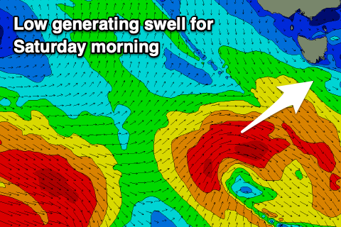
From the weekend we've got an upgrade in swell activity with a poorly aligned and small low forming south of WA due to move in from the west tomorrow evening, generating a fetch of W/SW gales in our south-west swell window.
Another 2-3ft pulse of swell is expected off this low Saturday morning and winds will be offshore from the NW ahead of a SW change early afternoon.
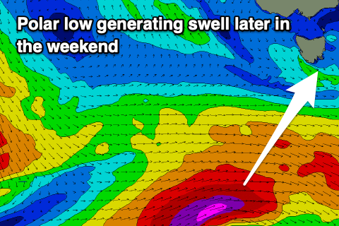
 Of greater importance are the developments of stronger polar lows in the wake of this initial system, with the first forming south-west of us Friday, generating a fetch of severe-gale to storm-force W/SW winds in our southern swell window.
A moderate sized S/SW groundswell should be seen off this low, arriving Sunday afternoon and kicking to a solid 4ft. A secondary low may form and produce a smaller reinforcing S/SW groundswell for Tuesday but we'll have to look at this again on Friday.
Winds Sunday afternoon look favourable for selected breaks and out of the NE, offshore from the N/NW Monday.

