Slow period ahead with swells from the west next week
Southern Tasmania Surf Forecast by Craig Brokensha (issued Friday 12th April)
Best Days: Sunday morning, exposded breaks Monday afternoon and Tuesday morning
Recap
A good reinforcing SW swell yesterday to 3ft across Clifton with offshore winds, while the swell has dropped right back this morning to a small though clean 1-2ft.
Today’s Forecaster Notes are brought to you by Rip Curl
This weekend and next week (Apr 13 - 19)
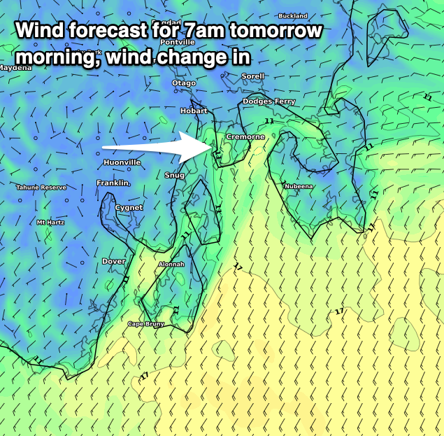
 Our small S/SW swell for tomorrow is still on track, but winds look worse with an onshore change due in by day break and around 6:30-7am. The swell was generated by a polar fetch of strong SW winds yesterday and should provide 2ft sets, though it will go to waste with the conditions.
Sunday should be cleaner with a light N'ly breeze, though tending NE mid-morning and freshening from the E/NE into the afternoon. Size wise the swell will be on the ease from 1-2ft.
The outlook for next week is pretty quiet. A small mid-period SW swell is likely to be seen Monday afternoon and Tuesday morning from a broad but poorly aligned fetch of strong W/NW winds moving through our swell window.
It only looks to come in at 1-1.5ft and with gusty NE winds Monday afternoon, favouring more exposed spots, N/NE Tuesday as it eases.
Longer term, as touched on last update the storm track will be focussed up towards WA and not in our swell window at all.
A local deepening low drifting south across us Thursday may generate a local increase in solid short-range W/SW swell Friday but we'll have to review this Monday. Have a great weekend!

