Small pulses of west swell for the period
Southern Tasmania Surf Forecast by Craig Brokensha (issued Friday 3rd August)
Best Days: Later Sunday, early Monday, Thursday, Friday morning
Recap
A small kick in long-period W/SW groundswell Wednesday afternoon eased back from a small clean 1-2ft yesterday, tiny into today.
Today’s Forecaster Notes are brought to you by Rip Curl
This weekend and next week (Aug 4 - 10)
 Want to receive an email when these Forecaster Notes are updated? Then log in here and update your preferences.
As touched on the last couple of updates, the coming forecast period isn't too active, with the storm track sitting too far north of us to generate any significant swells.
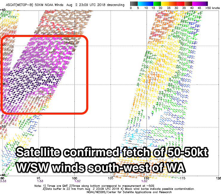
Our new inconsistent and long-range W/SW groundswell for later Sunday and eary Monday is still on track, with the severe-low linked to this showing up well on satellite. Core wind speeds of 50-55kt were observed in our far western swell window, the the low now positioned out of our swell window, south-west of WA.
We should see infrequent 1-2ft sets developing late Sunday, with the swell easing from a similar size early Monday.
 Winds will be good all day Sunday and fresh from the N'th, tending lighter N/NW as the swell kicks late, with N/NW tending W/NW winds Monday.
The surf will become tiny to flat until around Thursday when we may see one of the mid-latitude storms dipping south-east and aiming a fetch of W/SW gales through our western swell window Tuesday.
If this develops as planned, we should see some new W/SW swell arriving through Thursday and kicking to a strong 2ft+ into the afternoon across Clifton with NW winds.
This swell will then fade through Friday with small W/SW swells to follow, but more on this Monday. Have a great weekend!

