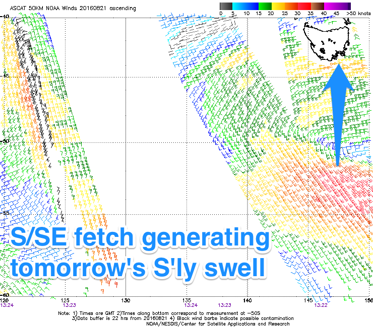
Fun S'ly swell for the coming days, better developments from the weekend
Southern Tasmania Surf Forecast by Craig Brokensha (issued Monday 22nd August)
Best Days:
Recap
Nothing to get excited about over the weekend with an acute W'ly swell hardly reaching 1ft on Saturday, slightly bigger into Sunday but back to a tiny 1ft+ today. A bit more size should have been seen this afternoon with a mix of SW windswell from stalling SW winds to our south-west.
This week (Aug 23 - 26)
 Tomorrow's S'ly swell is still on track, with satellite observations confirming a fetch of strong to gale-force S'ly winds stalling on the bottom side of the low that generating the weekend's and today's marginal swells.
A good kick to 3ft to possibly 4ft is due tomorrow, easing back slowly through Wednesday from 2-3ft.
Early W/NW winds are due tomorrow, swinging W/SW through the day, while Wednesday will play out similar.
Into Thursday smaller amounts of S/SE swell are due, maybe 1-2ft or so and again an early W/NW'ly is due, swinging S/SW through the day.
An inconsistent but fun SW groundswell is due Friday, with it being generated today and tomorrow by a strong polar low east of Heard Island. A fetch of severe-gale W'ly tending W/NW winds will be aimed through our swell window, with a good 2ft of swell due.
This swell will fade into Saturday under offshores ahead of a late SW change.
Saturday's SW change will be related to a strengthening and broadening polar frontal frontal progression firing up and stalling through our south-western swell window.
An initial front will generate a fetch of W/SW gales to our south-west Friday, stretching out further north towards us through Saturday, followed by stronger embedded fronts firing up along the same storm track, all related to a strong node of the Long Wave Trough across the Tasman Sea.
This should produce building and persistent levels of SW tending S/SW groundswell from Sunday through early next week. We'll have a closer look at this Wednesday though.

