Strong powerful and clean swell for Thursday
Southern Tasmania Surf Forecast by Craig Brokensha (issued Wednesday 15th June)
Best Days: Thursday, Friday morning, Saturday morning, Sunday
Recap
A slow start to the surf yesterday morning with sets to 2ft, but a strong new increase in size was seen through the afternoon but with an onshore change. This morning good clean easing 3ft sets were seen across Clifton with the swell dropping further through the day.
This week and weekend (Jun 16 – 19)
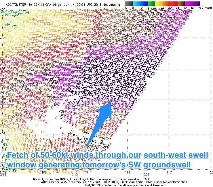
Our strong and powerful SW groundswell due through tomorrow is still on track, with satellite observations confirming a fetch of 50-60kt storm-force W'ly winds through our swell window the last couple of days.
 The vigorous polar frontal progression generating this swell is currently passing under us while continuing to generate storm-force winds.
With the storm-force winds, a long-period and powerful SW groundswell has resulted, with the bulk of the swell energy arriving in the high 16-17s bracket.
If the swell isn't there at dawn it will be well an truly in by mid-morning with Clifton expected to offer strong 3-5ft sets most of the day. Offshore N/NW winds will create clean conditions all day opening up plenty of options.
The swell will drop steadily through Friday likely from 3ft or so in the morning with an early NW'ly ahead of a SW change
Into the weekend two pulses of good W/SW groundswell are due across the region, generated by back to back polar fronts firing up under WA and pushing east towards us over the coming days.
We should see Clifton building to 2-3ft though the afternoon Saturday and easing from a similar size Sunday morning. A morning NW'ly is expected Saturday ahead of a weak SW change and then N/NW tending variable winds Sunday.
Longer term there's nothing really significant at all until later next week as the storm track becomes unfavourably aligned. Therefore make the most of the coming days swells.

