Poor outlook until next week
Southern Tasmania Surf Forecast by Craig Brokensha (issued Wednesday 27th January)
Best Days: Monday morning tiny peelers, Wednesday onwards next week
Recap
Tiny onshore waves yesterday, while today was tiny again but NE winds opened up more options across the region.
This week and weekend (Jan 28 – 31)
The coming few days will become near flat across the South Arm, with fresh to strong NE winds tomorrow, more E/NE into Friday, kicking up large levels of stormy swell on the East Coast.
The surface trough responsible for these winds will drift slowly south through the weekend, but a forecast fetch of E/SE winds through our swell window now looks to be just E'ly, resulting in no decent size across Clifton.
Some inconsistent long-range SW groundswell is due Saturday and then Sunday from a couple of strong polar lows firing up in our far swell window south-west of WA, but sets to only 1ft are due Saturday, better to an inconsistent 1-2ft Sunday. Conditions will be poor though with fresh and gusty E/SE winds, leaving limited options for a quality wave.
Next Monday onwards (Feb 1 onwards)
 Fading SW swell with better lighter N/NW offshores are due Monday morning, but only to 1-1.5ft max across Clifton.
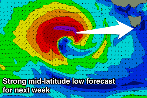
Of greater significance is a vigorous mid-latitude low that's forecast to develop under WA during the weekend, tracking east-southeast through our swell window through early next week.
This should generate some good W/SW groundswell for Wednesday onwards to 2ft to maybe 3ft, but have a check back here Friday for more details on this.

