Good clean S'ly swell tomorrow, easing into the weekend
South Australian Forecast by Craig Brokensha (issued Wednesday 30th August)
Best Days: South Coast Thursday, swell magnets Friday and Saturday, protected spots Sunday afternoon
Recap
Pumping waves across the South Coast yesterday with super clean and glassy conditions with 3-4ft of S/SW swell. Afternoon sea breezes created average conditions. Today the swell was back to 2-3ft of Middleton but nice and clean again with a morning offshore.
The Mid Coast saw tiny 0.5-1ft waves on the favourable parts of the tide the last two days with generally clean conditions.
This week and weekend (Aug 31 – Sep 3)
Tomorrow's looking great across the South Coast again, with a new S/SW swell due to peak during the morning, generated by a broad and not overly strong polar front projecting up into Tassie today.
Middleton should see good 3ft+ sets during the morning before easing into the afternoon, further down from the 2ft range Friday morning.
 The Mid Coast is expected to be tiny to flat with the swell being too south. Conditions will be good most of tomorrow with a fresh N/NE breeze, with fresh N/NW tending variable winds Friday.
Come Saturday the South Coast will be tiny with Waits and Parsons offering the only chance to surf but with fresh and gusty N/NE tending N/NW winds (easing later), making conditions tricky at times.
The tiny lift in swell due across the Mid Coast through the afternoon looks to have been downgraded a little. This swell was only due to reach 1-1.5ft but we're now looking at 1ft+ waves into the afternoon with a N/NW breeze.
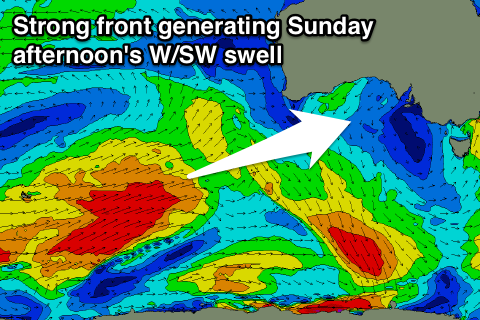
A better W/SW groundswell is due into Sunday, produced by a strong polar frontal system that's developed in the Heard Island region and is projecting towards WA.
A good but inconsistent W/SW groundswell is due off this system, building Sunday and reaching 3-4ft across Middleton into the afternoon and 2ft+ on the Mid Coast.
The swell will be over-ridden by a a stormy increase in W/SW swell on the Mid Coast as the remnants of the storm fire up into a mid-latitude through the Bight, projecting W/SW gales into us.
 The models are still slightly divergent regarding the positioning and strength of this low but we're likely to see stormy 3ft waves developing across the Mid with strong to gale-force W/NW winds.
The swell will be too west for the South Coast, with the groundswell building as protected locations offer the best waves.
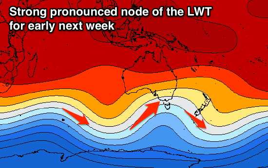
Now moving into next week, we're due to see one of the strongest cold-outbreaks we've seen this year occurring across the south-east of the country as a strong and pronounced node of the Long Wave Trough moves across us early next week.
This will project a flurry of strong frontal activity up and into us from Sunday through at least mid-week before the node shifts more east.
We'll see strong storm activity slammed into the state, but the models are still moving around regarding each successive front, so check back here Friday for a closer idea on this burst of wintery weather.

