South Coast Thursday/Friday, Mid Coast Sunday
South Australian Forecast (issued Wednesday 20th July)
Best Days: Thursday morning and Friday down South, Sunday on the Mid Coast (morning down South), Monday both coasts, Tuesday down South
Recap
The Mid Coast has hovered in the tiny 1ft range the last couple of days with generally clean conditions, while the South Coast saw a strong pulse of S/SW groundswell yesterday morning with early E'ly winds that tended lighter onshore into the early afternoon.
Today the surf was cleaner down South with a slight drop in size, with peaky waves under light NE winds. Conditions have started to deteriorate though with a slowly increasing S/SE'ly.
This week (Aug 21 - 22)
Tomorrow and Friday are still looking great for surf down South with the arrival of a long-range and very inconsistent SW groundswell and a medium-range S/SW swell across the coast.
These swells were produced by a strong polar frontal system developing in the Heard Island region over the weekend before pushing east along the polar shelf and under the country.
Middleton should offer inconsistent 3-4ft+ sets with larger 4-6ft bombs at Waits under N/NE tending E/NE breezes. The Mid Coast isn't expected to see any size above a tiny 0.5ft.
Friday will be the pick with a fresh and gusty N/NE wind persisting all day as the swell eases steadily from 3ft+ at Middleton and 3-5ft at Waits early.
This weekend onwards (Aug 24 onwards)
Saturday will be a good lay day as the swell becomes tiny down South under strong N'ly tending SW winds, and although a late increase in strong W/SW groundswell is due across the Mid to 1-2ft, onshore winds will create average conditions.
 Sunday however looks excellent on the Mid Coast as the strong W/SW groundswell peaks under light variable winds (likely tending locally offshore through the morning).
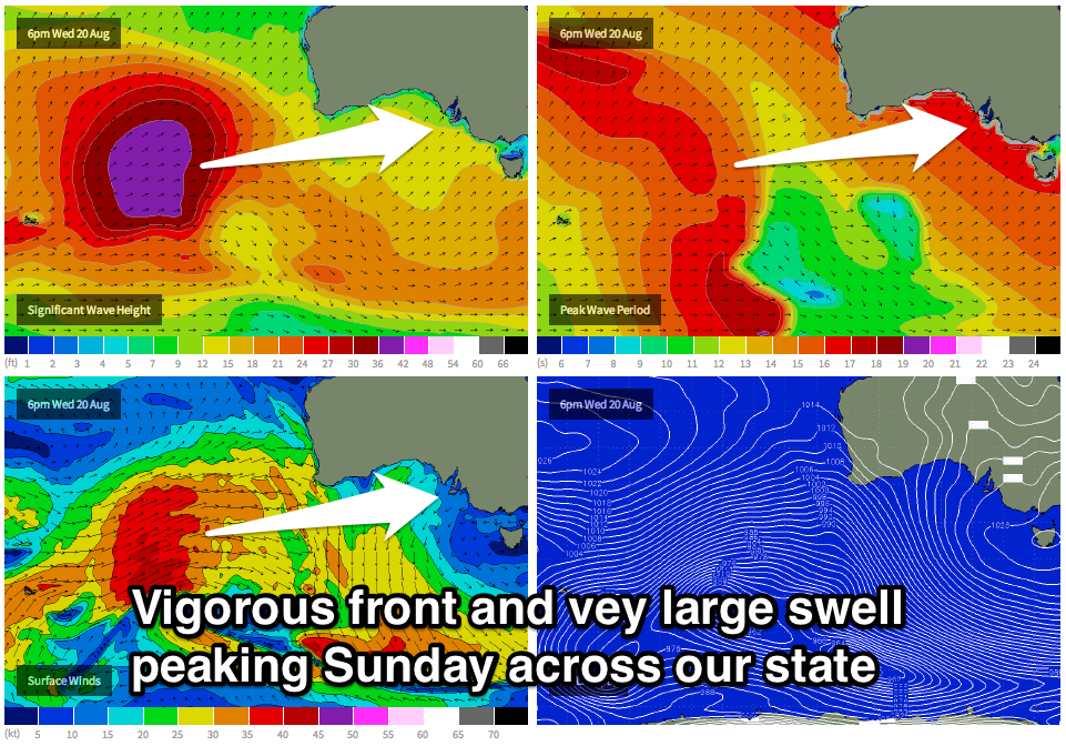
Currently a very strong, broad and elongated polar front is being steered up towards WA by the Long Wave Trough before weakening considerably once if passes across WA on Friday.
An oversized W/SW groundswell will be generated for WA, with a fair bit of swell decay seen as it travels towards us. Still the sheer size of the swell should still result in moderate to large levels of W/SW groundswell arriving late Saturday and peaking Sunday morning
The Mid Coast should see good 2-3ft sets with those light offshore winds while the South Coast should offer inconsistent 4-5ft sets at Middleton with larger 6ft+ bombs at exposed spots. Winds will however swing from an early W'ly down Victor around to the S'th during the day, so the morning will be best.
Into next week the swell will drop away under excellent N/NE winds, while another strong pulse of long-range W/SW groundswell is due later Wednesday and Thursday, but not to the size of Sunday's. More on this Friday.

