Solid swell incoming with problem winds improving Mon-Tues
Eastern Tasmanian Surf Forecast by Steve Shearer (issued Fri July 8th)
Features of the Forecast (tl;dr)
- Steep increase in S swell Fri PM, with fun E/NE swell
- Chunky S swell Sat with fresh S to SSE winds
- Solid E/SE groundswell Sun, holding with plenty of size Mon and improving winds
- Another pulse of E/SE swell expected Wed next week with offshore winds
- More S swell likely towards the end of next week
Recap
Small levels of E/NE swell Thurs in the 1-2ft range have increased today into the 2ft range and larger with a steep increase in new S swell also on the build through the a’noon as S’ly winds freshen in relation to a new trough of low pressure off Tasmania.
This weekend and next week (July8 – Jul 15)
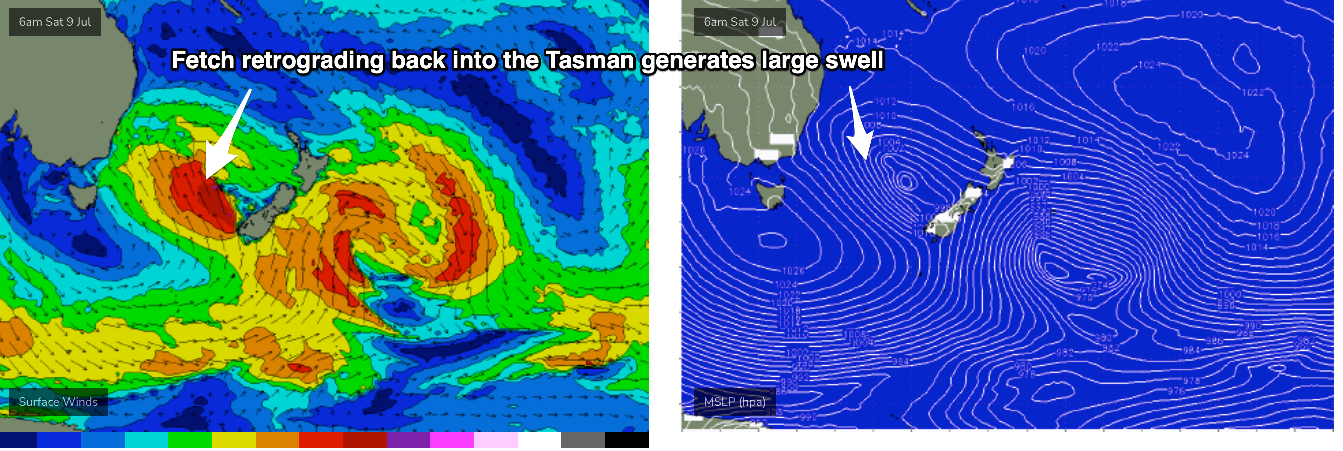
We are still under the influence of a slow moving, complex Tasman Low (formerly ECL), a strong high in the Bight and a weak trough/low forming near Tasmania. The new trough/low is generating gales out of Bass Strait and up towards the South Coast. The main low is drifting towards the South Island and intensifying today, with gales to severe gales expected to retrograde NW back into the Tasman Sea (see below), generating a large swell for Sun/Mon.
No change to the weekend f/cast. Large S swell Sat with fresh S’ly winds tending SSE in the a’noon, will confine surfing to protected locations. Expect size in the 6ft range, with SE swell overlapping the more shorter period S swell later in the day.
Longer period SE-E/SE swell peaks Sun from the retrograding low with size in the 6ft+ range and a lingering onshore flow, steadily decreasing in strength through the day as high pressure moves SE of the Island.
Large leftovers carry plenty of size into Mon with sets to 5-6ft, easing through the day. Winds improve as a light N’ly flow sets in, tending more NW in the a’noon.
Clean leftovers make Tuesday one to pencil in, but watch out for a late S’ly change.
A new cold front Wed sees an increase in S swell, along with a new pulse of E/SE swell from under the South Island. Expect size in the 4-5ft range but with fresh S’ly winds being an issue.
By the end of next week we’ll see an easing trend with surf becoming tiny into next weekend 16-17 July.
Check back Mon for the latest update and have a great weekend!


