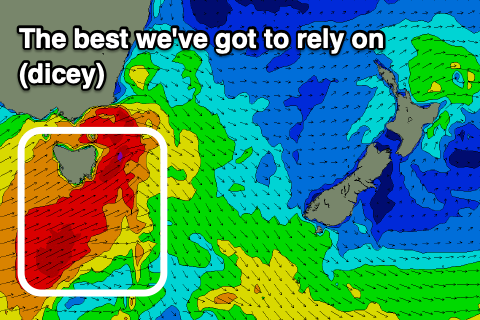
One small window to target
Eastern Tasmania Forecast by Craig Brokensha (issued Wednesday 26th August)
Best Days: Friday afternoon
Recap
Fun easing levels of S/SE-S swell yesterday with favourable conditions, dropping back in size today and much smaller.
This week and weekend (Aug 27 - 30)
An additional small pulse of S’ly swell to 1-2ft this afternoon will ease tomorrow with favourable and strengthening N/NW winds.
 This will be ahead of a strong cold front moving in and under us, with it expected to produce a good pulse of S’ly groundswell for Friday afternoon.
The front is currently strengthening south-southwest of WA and will produce a fetch of severe-gale W/SW winds out of our swell window, but as it pushes up and across us Friday morning, we’ll see strong to gale-force SW winds generated in our swell window.
The system will be quite fast moving and fairly zonal, resulting in a fleeting pulse of S’ly groundswell Friday afternoon to 3ft+ on the south magnets, fading rapidly Saturday from 2ft max.
Conditions should be favourable with a W/NW-NW offshore all day Friday, NW-N/NW on Saturday.
Following this there’s nothing too significant on the cards for us into early next week besides another possible fleeing pulse of swell Monday, but the models diverge regarding the mid-latitude low linked to this.
So if looking for a wave this period, target Friday afternoon and evening for a surf.

