Easing S'ly swell with a larger swell next week
Eastern Tasmania Forecast by Craig Brokensha (issued Wednesday 6th May)
Best Days: Saturday morning, Wednesday onwards
Recap
Flat yesterday but a new S'ly groundswell due today came in good across south swell magnets with 4ft sets under offshore winds. Open beaches were smaller and in the 2-3ft range.
 This weekend and next week (May 9 - 15)
Today's pulse of S'ly groundswell should fade overnight with easing 2-3ft sets across south swell magnets under W/NW winds.
Come Sunday the coast is due to be flat again with the next significant increase in S'ly swell due into Wednesday and more so Thursday/Friday.
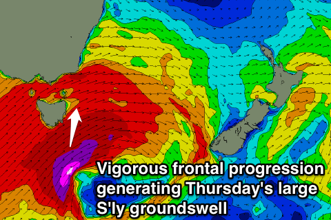
This will be generated by a very strong and slow moving frontal progression moving in from the west mid-week, with a fetch of severe-gale SW winds due to be aimed on the edge of our swell window Tuesday afternoon and evening, generating a small refracted S'ly groundswell for Wednesday morning to the 3-4ft range across south swell magnets.
Behind this though a better aligned fetch of gale-force S/SW winds should be aimed up through our southern swell window Wednesday and Thursday, generating a larger S'ly groundswell event.
South facing beaches look to reach to 6-8ft range during Thursday with gale-force SW winds.
Friday should then see the swell start to ease from the 6ft range with better W/SW winds, swinging offshore for south swell magnets from the W/NW Saturday as the swell continues to ease.
The models are still moving around regarding the timing and size of these swells so we'll have a closer look on Monday. Have a great weekend!

