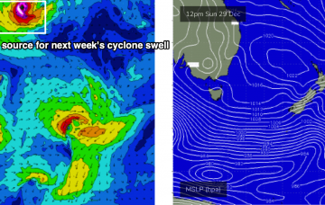
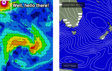
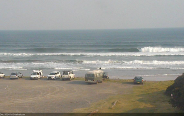
The tropical cyclone mentioned in Monday’s and Friday’s notes is still well and truly on the radar. Unfortunately, we don't have the kind of wind forecast you hope will coincide with an easterly groundswell event of this kind. More in the Forecaster Notes.
Primary tabs
As mentioned in Friday’s notes, a Tropical Cyclone is expected to form north of Fiji around Xmas Day or Boxing Day. Current expectations have it tracking south, finally entering our swell window this Friday or Saturday. More in the Forecaster Notes.
The responsible Southern Ocean low is an absolute beast (see below) and despite being located SW of Tasmania as it undergoes primary swell production, will be sufficiently south in latitude to favour a significant swell event. More in the Forecaster Notes.
A powerful Southern Ocean low south-west of Tasmania later this week will track through our acute south swell window over the following days, generating some impressive S’ly swell for our region that’ll arrive over a few stages. More in the Forecaster Notes.
It’s important to distinguish between individual swell trains too. A short but robust fetch trailing today’s change is already generating S’ly windswells for Northern NSW, but S/SE swell from the parent low will arrive later tomorrow and should reach a peak in size early Wednesday. More in the Forecaster Notes.
The weekend looks pretty poor, but a better quality groundswell is expected mid-next week, generated by a nice low in the lower Tasman Sea on Monday. More in the Forecaster Notes.
With a low swell outlook it’s not really worth worrying about too much. More in the Forecaster Notes.
We’ve got a tricky week of local winds, which will have a major bearing on surf quality in a few regions. More in the Forecaster Notes.
The parent low to all of the fronts responsible for this week’s seemingly endless southerly swells is now moving out from beneath the Tasmanian swell shadow (see chart below), and will generate building S’ly swells into Sunday. More in the Forecaster Notes.
We’ve got a stack of south swell on the way for Northern NSW. But, I don’t think the models are handling the outlook well, and are undercalling wave heights, as they are today. More in the Forecaster Notes.

