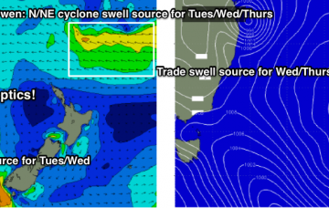
And, we can’t ignore the Tropical Coral Sea and South Pacific, can we?
Primary tabs
/reports/forecaster-notes/sydney-hunter-illawarra/2018/12/28/stacks-and-stacks-and-stacks-swell-ahead
thermalben
Friday, 28 December 2018
/reports/forecaster-notes/sydney-hunter-illawarra/2018/12/26/stacks-surf-ahead-summery-noreasters
thermalben
Wednesday, 26 December 2018
The easing E’ly swell will be replaced by building NE windswell. More in the Forecaster Notes.
/reports/forecaster-notes/sydney-hunter-illawarra/2018/12/24/lots-swell-ahead-though-winds-look-be
thermalben
Monday, 24 December 2018
We’ve got some fun swell inbound for the Xmas period, though freshening NE winds will create bumpy conditions at times.
/reports/forecaster-notes/sydney-hunter-illawarra/2018/12/21/coupla-dicey-days-coupla-gooduns-too
thermalben
Friday, 21 December 2018
A trough is expected to strengthen in the north-eastern Tasman Sea on Sunday (in the wake of Saturday’s S’ly change) and this is expected to remain slow moving for a few days.
/reports/forecaster-notes/sydney-hunter-illawarra/2018/12/19/couple-fun-swells-and-brief-windows-good
thermalben
Wednesday, 19 December 2018
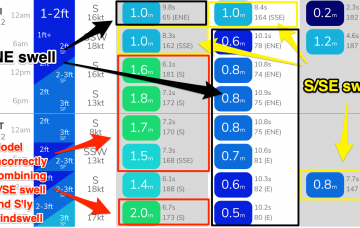
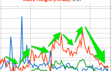
Of more interest are two long range swells that will provide more size and strength to the surf zone. They are both starting to show across the coast and should appear more prominently across the region ahead of peak in size on Friday. More in the Forecaster Notes.
/reports/forecaster-notes/sydney-hunter-illawarra/2018/12/17/abundance-swell-sources-none-em-large
thermalben
Monday, 17 December 2018
The weekend’s deep inland trough responsible for the persistent northerly flow has now pushed into the southern Tasman Sea, formed into a closed low, and is developing a reasonable southerly fetch about its western flank.
/reports/forecaster-notes/sydney-hunter-illawarra/2018/12/14/solid-weekend-ne-swell-only-brief
thermalben
Friday, 14 December 2018
There won’t be any shortage of NE swell this weekend, but the accompanying winds will generally be fresh and gusty from the same direction, so quality will be somewhat limited for the most part.
/reports/forecaster-notes/sydney-hunter-illawarra/2018/12/12/extended-period-solid-ne-swells-ahead
thermalben
Wednesday, 12 December 2018
So, the weekend’s forecast has been scaled up a little since Monday's notes were issued. More in the Forecaster Notes.
/reports/forecaster-notes/sydney-hunter-illawarra/2018/12/10/average-couple-days-then-dynamic-slow
thermalben
Monday, 10 December 2018
A stationary synoptic pattern across the the Tasman Sea will deliver mixed results in the surf department over the coming days.
/reports/forecaster-notes/sydney-hunter-illawarra/2018/12/07/fun-summery-swells-next-few-days
thermalben
Friday, 7 December 2018
We’ve got a classic summer pattern ahead for the weekend, with a stationary high in the Tasman Sea and a mix of swells from the E/NE and NE.