/reports/forecaster-notes/sydney-hunter-illawarra/2015/04/20/large-storm-swell-tuesday-good-windows
thermalben
Monday, 20 April 2015
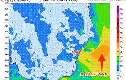
The broader synoptic outlook is a little complex as the atmospheric models have a couple of solutions possible for the next few days.
/reports/forecaster-notes/sydney-hunter-illawarra/2015/04/17/poor-weekend-large-and-windy-next-week
thermalben
Friday, 17 April 2015
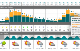
As discussed all of last week, we’ve got a proper East Coast Low developing early next week, in the wake of Sunday’s southerly change.
/reports/forecaster-notes/sydney-hunter-illawarra/2015/04/15/smaller-surf-till-weekend-large-and
thermalben
Wednesday, 15 April 2015
The current S/SE swell will continue a downwards trend for the next few days, but it’ll be supplemented by a small secondary pulse from the same direction on Thursday afternoon.
/reports/forecaster-notes/sydney-hunter-illawarra/2015/04/13/large-easing-sse-swell-good-morning
thermalben
Monday, 13 April 2015
The timing of this south swell is quite unfortunate - we’re going to see it peak overnight and then trend downwards all day Tuesday.
/reports/forecaster-notes/sydney-hunter-illawarra/2015/04/10/easing-swell-weekend-large-sly-swell
thermalben
Friday, 10 April 2015
We're still looking good for Saturday although wave heights will continue a steady downwards trend as they have this afternoon.
/reports/forecaster-notes/sydney-hunter-illawarra/2015/04/08/large-and-windy-thurs-easing-fri-then
thermalben
Wednesday, 8 April 2015
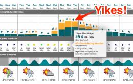
Large and windy: that’s the top line overview for Thursday.
/reports/forecaster-notes/sydney-hunter-illawarra/2015/04/06/large-windy-sly-swell-late-wednesday-and
thermalben
Monday, 6 April 2015
Wednesday will be a day of dynamics on the synoptic front.
/reports/forecaster-notes/sydney-hunter-illawarra/2015/04/03/potential-late-pulse-sunday-big-sly
thermalben
Friday, 3 April 2015
There are some crucial differences in the atmospheric model forecasts that could be make-or-break for a great surf session, or an average one.
/reports/forecaster-notes/sydney-hunter-illawarra/2015/04/01/tricky-period-ahead-sunday-pick
thermalben
Wednesday, 1 April 2015
Sunday has plenty of potential for some good waves.
/reports/forecaster-notes/sydney-hunter-illawarra/2015/03/30/poor-week-windy-weekend-long-term-looks
thermalben
Monday, 30 March 2015
In any case, I’d quietly pencil out Tuesday and Wednesday from your diary and consider extending your Easter break to capitalise on what could end up being a very tidy Autumn groundswell for the East Coast.

