South East Queensland and Northern New South Wales Surf Forecast (issued Monday 7th April)
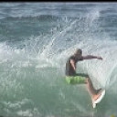

Next week has the potential to be quite interesting........ As the blind man says, "we'll see".........


Loving it Ben.
I reckon Access Bom are following your WAMS.
You have worked hard for your computer modelling and I reckon you guys are going well.
Big up :)


"We’re looking at a steady upwards trend all day Tuesday,"
Actually, the surf peaked in size Mon afternoon with well OH sets at the Point. Today was a weak and dribbly 2-3ft..........something obviously went wrong with that fetch because the : "great waves across the points" was very underwhelming.


Steve I don't know where you surfed today but I surfed this morning at a non-south facing beach and it was a solid but raw 3-4ft. Swell did die with the outgoing tide and was back to 2-3ft by around 8am.


thermalben wrote:GFS is a strong outlier at this stage. Seems to be a very unlikely scenario.
JTWC would beg to differ Ben!!!
http://www.usno.navy.mil/NOOC/nmfc-ph/RSS/jtwc/warnings/sh2314web.txt


Don. Have you noticed how this system has kept the monsoon active, and that several smaller systems over the past week have continued to deliver decent swell to east coast north island NZ?


DonW, I surfed twice in front of my house, a classic SE facing semi-exposed Point, and checked thirty K's of Northern NSW coast.
Swell definitely dropped off Tuesday compared to Mondays initial surge.
But Ben is probs right: the better qual groundy phase of the swell is running later than the initial windswell.
edit: Nope. Looks smaller and weaker again today.


Steve I was merely pointing out the size where I surfed.
Ben, I didn't say JTWC was a model. I was just noting they were saying EC and UKMET were the outliers and they are favouring GFS whilst you're indicating the opposite.


I hear you Don, and I was merely pointing out the fact that the surf was supposed to build Tuesday and it didn't. It was clearly smaller than Mon.


Not sure why you can't access the JTWC site Ben as I can access it. My reading of their words is that they believe the GFS forecast skirting the east coast as more plausible than the Cape York crossing.
WTPS31 PGTW 082100
MSGID/GENADMIN/JOINT TYPHOON WRNCEN PEARL HARBOR HI//
SUBJ/TROPICAL CYCLONE 23P (ITA) WARNING NR 009//
RMKS/
1. TROPICAL CYCLONE 23P (ITA) WARNING NR 009
01 ACTIVE TROPICAL CYCLONE IN SOUTHPAC
MAX SUSTAINED WINDS BASED ON ONE-MINUTE AVERAGE
WIND RADII VALID OVER OPEN WATER ONLY
---
WARNING POSITION:
081800Z --- NEAR 11.4S 152.0E
MOVEMENT PAST SIX HOURS - 270 DEGREES AT 03 KTS
POSITION ACCURATE TO WITHIN 040 NM
POSITION BASED ON CENTER LOCATED BY SATELLITE
PRESENT WIND DISTRIBUTION:
MAX SUSTAINED WINDS - 070 KT, GUSTS 085 KT
WIND RADII VALID OVER OPEN WATER ONLY
RADIUS OF 064 KT WINDS - 020 NM NORTHEAST QUADRANT
020 NM SOUTHEAST QUADRANT
020 NM SOUTHWEST QUADRANT
020 NM NORTHWEST QUADRANT
RADIUS OF 050 KT WINDS - 035 NM NORTHEAST QUADRANT
050 NM SOUTHEAST QUADRANT
050 NM SOUTHWEST QUADRANT
035 NM NORTHWEST QUADRANT
RADIUS OF 034 KT WINDS - 090 NM NORTHEAST QUADRANT
110 NM SOUTHEAST QUADRANT
110 NM SOUTHWEST QUADRANT
090 NM NORTHWEST QUADRANT
REPEAT POSIT: 11.4S 152.0E
---
FORECASTS:
12 HRS, VALID AT:
090600Z --- 11.4S 150.6E
MAX SUSTAINED WINDS - 080 KT, GUSTS 100 KT
WIND RADII VALID OVER OPEN WATER ONLY
RADIUS OF 064 KT WINDS - 025 NM NORTHEAST QUADRANT
030 NM SOUTHEAST QUADRANT
030 NM SOUTHWEST QUADRANT
025 NM NORTHWEST QUADRANT
RADIUS OF 050 KT WINDS - 050 NM NORTHEAST QUADRANT
065 NM SOUTHEAST QUADRANT
065 NM SOUTHWEST QUADRANT
050 NM NORTHWEST QUADRANT
RADIUS OF 034 KT WINDS - 085 NM NORTHEAST QUADRANT
100 NM SOUTHEAST QUADRANT
100 NM SOUTHWEST QUADRANT
075 NM NORTHWEST QUADRANT
VECTOR TO 24 HR POSIT: 250 DEG/ 09 KTS
---
24 HRS, VALID AT:
091800Z --- 12.0S 148.9E
MAX SUSTAINED WINDS - 090 KT, GUSTS 110 KT
WIND RADII VALID OVER OPEN WATER ONLY
RADIUS OF 064 KT WINDS - 025 NM NORTHEAST QUADRANT
025 NM SOUTHEAST QUADRANT
025 NM SOUTHWEST QUADRANT
025 NM NORTHWEST QUADRANT
RADIUS OF 050 KT WINDS - 050 NM NORTHEAST QUADRANT
060 NM SOUTHEAST QUADRANT
060 NM SOUTHWEST QUADRANT
050 NM NORTHWEST QUADRANT
RADIUS OF 034 KT WINDS - 100 NM NORTHEAST QUADRANT
110 NM SOUTHEAST QUADRANT
110 NM SOUTHWEST QUADRANT
100 NM NORTHWEST QUADRANT
VECTOR TO 36 HR POSIT: 245 DEG/ 09 KTS
---
36 HRS, VALID AT:
100600Z --- 12.7S 147.3E
MAX SUSTAINED WINDS - 100 KT, GUSTS 125 KT
WIND RADII VALID OVER OPEN WATER ONLY
RADIUS OF 064 KT WINDS - 030 NM NORTHEAST QUADRANT
030 NM SOUTHEAST QUADRANT
030 NM SOUTHWEST QUADRANT
030 NM NORTHWEST QUADRANT
RADIUS OF 050 KT WINDS - 055 NM NORTHEAST QUADRANT
065 NM SOUTHEAST QUADRANT
065 NM SOUTHWEST QUADRANT
055 NM NORTHWEST QUADRANT
RADIUS OF 034 KT WINDS - 110 NM NORTHEAST QUADRANT
120 NM SOUTHEAST QUADRANT
120 NM SOUTHWEST QUADRANT
110 NM NORTHWEST QUADRANT
VECTOR TO 48 HR POSIT: 235 DEG/ 07 KTS
---
EXTENDED OUTLOOK:
48 HRS, VALID AT:
101800Z --- 13.5S 146.2E
MAX SUSTAINED WINDS - 110 KT, GUSTS 135 KT
WIND RADII VALID OVER OPEN WATER ONLY
RADIUS OF 064 KT WINDS - 035 NM NORTHEAST QUADRANT
035 NM SOUTHEAST QUADRANT
035 NM SOUTHWEST QUADRANT
035 NM NORTHWEST QUADRANT
RADIUS OF 050 KT WINDS - 055 NM NORTHEAST QUADRANT
055 NM SOUTHEAST QUADRANT
055 NM SOUTHWEST QUADRANT
055 NM NORTHWEST QUADRANT
RADIUS OF 034 KT WINDS - 110 NM NORTHEAST QUADRANT
110 NM SOUTHEAST QUADRANT
100 NM SOUTHWEST QUADRANT
100 NM NORTHWEST QUADRANT
VECTOR TO 72 HR POSIT: 185 DEG/ 07 KTS
---
72 HRS, VALID AT:
111800Z --- 16.1S 145.9E
MAX SUSTAINED WINDS - 085 KT, GUSTS 105 KT
WIND RADII VALID OVER OPEN WATER ONLY
RADIUS OF 064 KT WINDS - 035 NM NORTHEAST QUADRANT
035 NM SOUTHEAST QUADRANT
035 NM SOUTHWEST QUADRANT
035 NM NORTHWEST QUADRANT
RADIUS OF 050 KT WINDS - 045 NM NORTHEAST QUADRANT
045 NM SOUTHEAST QUADRANT
040 NM SOUTHWEST QUADRANT
040 NM NORTHWEST QUADRANT
RADIUS OF 034 KT WINDS - 100 NM NORTHEAST QUADRANT
100 NM SOUTHEAST QUADRANT
095 NM SOUTHWEST QUADRANT
095 NM NORTHWEST QUADRANT
VECTOR TO 96 HR POSIT: 145 DEG/ 09 KTS
---
LONG RANGE OUTLOOK:
---
96 HRS, VALID AT:
121800Z --- 19.0S 148.1E
MAX SUSTAINED WINDS - 070 KT, GUSTS 085 KT
WIND RADII VALID OVER OPEN WATER ONLY
VECTOR TO 120 HR POSIT: 130 DEG/ 10 KTS
---
120 HRS, VALID AT:
131800Z --- 21.6S 151.2E
MAX SUSTAINED WINDS - 055 KT, GUSTS 070 KT
WIND RADII VALID OVER OPEN WATER ONLY
BECOMING EXTRATROPICAL
---
REMARKS:
082100Z POSITION NEAR 11.4S 151.7E.
TROPICAL CYCLONE (TC) 23P (ITA), LOCATED APPROXIMATELY 489 NM
NORTHEAST OF CAIRNS, AUSTRALIA, HAS TRACKED WESTWARD AT 03 KNOTS
OVER THE PAST SIX HOURS. ANIMATED ENHANCED INFRARED SATELLITE
IMAGERY DEPICTS A CONSOLIDATING LOW-LEVEL CIRCULATION CENTER (LLCC)
WITH A CENTRAL DENSE OVERCAST FEATURE. A 081707Z SSMI IMAGE DEPICTS
TIGHTLY-CURVED DEEP CONVECTIVE BANDING WRAPPING INTO THE LLCC. THERE
IS GOOD CONFIDENCE IN THE INITIAL POSITION BASED ON THE
AFOREMENTIONED IMAGERY. THE INITIAL INTENSITY IS ASSESSED AT 70
KNOTS BASED ON DVORAK ESTIMATES FROM PGTW AND KNES RANGING FROM 65
TO 77 KNOTS. TC 23P HAS TRACKED WESTWARD UNDER THE STEERING
INFLUENCE OF THE MID-LEVEL SUBTROPICAL RIDGE (STR) POSITIONED OVER
THE CORAL SEA. THE BULK OF THE AVAILABLE DYNAMIC MODEL GUIDANCE IS
IN FAIR AGREEMENT, THEREFORE, THE FORECAST IS POSITIONED CLOSE TO
THE MULTI-MODEL CONSENSUS. THE ONLY EXCEPTIONS ARE ECMWF AND JGSM
SOLUTIONS, WHICH INDICATE AN UNLIKELY WEST-SOUTHWESTWARD TO
SOUTHWESTWARD TRACK OVER THE CAPE YORK PENINSULA. THERE IS
INCREASING UNCERTAINTY AFTER TAU 48 DUE TO AN APPROACHING MAJOR
SHORTWAVE TROUGH, CURRENTLY POSITIONED OVER CENTRAL AUSTRALIA, WHICH
WILL SERVE TO WEAKEN THE WESTERN EXTENT OF THE STR AND PROVIDE A
POLEWARD STEERING PATTERN. THE JTWC FORECAST FAVORS THE NAVGEM AND
GFS SOLUTIONS. TC 23P IS FORECAST TO INTENSIFY TO A PEAK INTENSITY
OF 110 KNOTS BY TAU 48 DUE TO FAVORABLE POLEWARD OUTFLOW AND WARM
SST (28 TO 29 CELSIUS). BY TAU 72, THE SYSTEM WILL WEAKEN DUE TO
LAND INTERACTION AS IT SKIRTS THE EAST COAST OF AUSTRALIA. TC 23P IS
FORECAST TO BEGIN EXTRA-TROPICAL TRANSITION NEAR TAU 120. MAXIMUM
SIGNIFICANT WAVE HEIGHT AT 081800Z IS 23 FEET. NEXT WARNINGS AT
090900Z AND 092100Z.//


Well, if dromo' had've taken my sunday tip, he would've scored quite well.... Swell peaked Monday arvo, with north of Moreton picking up most of the size, and the swell getting smaller the further south you go..So, if you are out there dromo, did you get my cryptic tide clue? Did you go to the "end of the track"?


Ben - I wrote "Next week has the potential to be quite interesting........ As the blind man says, "we'll see"........."
Whatever way you look at it, next week will be interesting, whether it's Agnes with a reformed low, or Dbah/ nth NSW with a south swell....


Sunday was one of the best days of the year at Nth end of sunny Coast beach breaks,Monday southerly came in early,waves were good quality on the Points but depressingly inconsistent.Looked good right out maybe 2-4ft but a little full.Tuesday no good any where up Nth end of Coast.Except maybe Nth of the River.
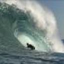

Yep sunday was cooking at Sth Strads. morning sickness and building swell before 9am, but by 9:30 it was 6ft on the sets north of the pipes, clean as and freight training


Toby - look at monday arvo here - http://www.ehp.qld.gov.au/coastal/monitoring/waves/site_param.php?siteid...
One particular spot would have been real fun.......


That increase in size Monday afternoon Sheepdog is from localised windswell and not the groundswell muscling up. You can identify it by the peak periods alternating between 15 and 5 seconds.


Craig, no doubt, but there was still good energy from the groundswell on Monday, which you guys have stated twice , in two forecasts, and was documented at 3- 4 foot on the daily report..... and from what I've been told "the end of the track" was very good... You know the place... You walked out and took photos of it when you were there..... Protected from the monday southerly, and alot more consistent than further inside the bay... Alot of sand there at the moment, and a high tide that wasn't a high tide.........


Yeah for sure, I surfed it as well as taking photos. But it seemed like you were attributing the spike in size on the buoy to a stronger pulse of groundswell, when it wasn't, just local windswell kicking up the buoy wave heights :)


Nah.... those two spikes seem dodgy, (two similar spikes at Mooloolabah though), but overall the sig' had a gradual increase, in alignment with your forecast, and period seemed to still have a constant 14 sec', besides the windswell....
This was basically a conversation started with dromodreamer back on Sunday..... i was just hoping he was going to poke his head in after I gave him a couple of tips for monday...... Maybe he scored it uncrowded and has gone slightly mad? Perhaps he is jibbering in a padded cell? ;)


yocal wrote:Yep sunday was cooking at Sth Strads. morning sickness and building swell before 9am, but by 9:30 it was 6ft on the sets north of the pipes, clean as and freight training
Gutted Yocal, got home Tuesday, love that place it has emotion and mood every time I go over :)


Well well it appears JWTC were on the money with their call. Most models now agreeing with GFS and ITA tracking parallel to the coast now. GFS got this one over nearly all the other models it seems.


Very dynamic period ahead, and it's all positive!


But, Don!!!! You weren't interested!!!!! "we won't see any swell from her down here so I'm not really too interested in her".... ;)
Ben - "In any case I don't see much swell potential (for SE Qld) from this system either"
Craig - "Haha, yeah GFS is dreaming!"
You guys are funny "ha ha".... :)
All I can say is gfsaccessgecabcdefg...... What will be will be...... Because this system stuck so close to PNG, it made it hard for all models to get a grip..... Now it is in open warm ocean, all models MAY have a better chance....... Grace (2004) and Hamish (2009), both march storms, both of which I was lucky score, also moved down the Qld coast, but a bit further offshore...
And for interests sake, Monica ended up near Darwin, and the remnants of Oswald stayed inland, and actually moved off the south NSW coast, and eventuated to not much except maybe a days swell for east coast tassie....


That was from 3rd of April Sheepdog, the models hadn't firmed on what Ita was doing until today (a week later), so could of gone any way.
And it had a large groundswell for this weekend, not happening, so it was dreamland..


Hey Doggie, its April brother.


Yeah I know... Just stirrin ya boys!!!!!!! When a large N ne groundswell was echoed for SEQ, I nearly fell over laughing... I have never seen a large n ne groundswell in all my life... Seen some ne short period New cal crap, but never a serious groundswell....
But back on the 1st of April, here's what I wrote, totally discarding all models.....
"Your opinion on that broad low near the Solomans?
I personally wouldn't enter a "hold my breath" comp' on it... It is far enough north for this time of year, though..... Early tomorrow morning thru thursday will tell the tale as ene winds feed into the se flank...... "
And guess what? She ramped up wed, thurs, fri, and by sat, Ita was born.... And I was spot on about PNG, aye ;)
Here's another thing huey told me, back on the 2nd of april -
"I have seen situations where two systems like this merge. The merging area would be around New Cal'.
I'm not calling anything..... I have also seen Solomon lows disintegrate ( April in particular), and I have seen them wreck FNQ (Larry)...... It's just worth watching for future reference, that's all..."
So.... looks like 2 systems may merge AND a bit of wreckage up north..... but merger will be south of New Cal...... causing a super storm..... But still, don't hold your breath...... Cos I'm phoning Huey up, and telling him he's a c*** re' merger area....... I'll tell him the banks are good and we don't want them ruined, and please send the low to Mt Isa..... They need the rain ;p


freeride76 wrote:Hey Doggie, its April brother.
Yeah, bloke.... I know..... If I hadn't of specified those storms were in march, some smarty pants would've pointed it out, being April and all ;) My point was that those two storms were the last two storms to move parallel down the qld coast, which models suggest Ita will do.... Just those two storms were further off the coast...
As the blind man says, "we'll see"...
Hope you've been scoring a few, free ride.......


""I have seen situations where two systems like this merge. The merging area would be around New Cal'.
I'm not calling anything..... I have also seen Solomon lows disintegrate ( April in particular), and I have seen them wreck FNQ (Larry)...... It's just worth watching for future reference, that's all...""
SD, everything you wrote here was a bet each way, so you could easily come back down the track and said "I told ya so, boys".


SD, I'm gonna go out on a massive limb here and say:
A) you're an only child; or
B) you're the first child; or
C) you're the 3rd child with a big age difference between you and the first 2 children.


donweather wrote:SD, I'm gonna go out on a massive limb here and say:
A) you're an only child; or
B) you're the first child; or
C) you're the 3rd child with a big age difference between you and the first 2 children.
Jesus Christ, Don!!! None from 3!!!!! But from a bloke who wasn't interested in a cyclone, what do you expect...... ;)
ps - your the eldest, cos even when you've been shown up, you try to bully your way out of it.......
Now wax up donny, do some crunches, keep those joints flexible..... A big holiday swell is on the way..... Cheers, mate.....


Meanwhile in Port Douglas...1ft dribble :-( heading down tomorrow, apparently it's been busy between here and Ellis


Hey SD I just watched a show called tornado on SBS, (as you do a 3 am) The naysayers in the weather bureau didn't believe him but he analysed the data...Berlin= tornado alley and who was right- Hello F5 in zee muzerland- take that politician who didn't want to pay for a warning system! And guess where i wasn't on Monday.... Guess where I was on Tuesday bobbing around like a bait fish and suffering the indignity of PADDLING IN!! Who's there? What? Open the door! Open the Door! Get Me out of here, I'm sane as any man honest HONEST ARHHHHH!!


Loving your work doggie but Hamish and Grace never crossed and then recurved back out to sea.
This one is a bit unique.


SD I'm the youngest mate.
And I couldn't care less about the Easter swell. It'll be a points only affair and the Easter crowds will be mayhem so the clowns can have it. I've had my share of super fun uncrowded beachies with epic banks this week. And I can tell you now, there is no one here on the Goldy yet so obviously everyone is coming to town for Easter!!!
Oh and when I said I wasn't interested in TC Ita I meant from a swell perspective. I'm always interested in the weather charts particularly when such an outlier as GFS was, got it so spot on.


Free ride, re hamish and grace; Yep.... As I said "Just those two storms were further off the coast..." Ita is a peculiar "gal".... But with such an iconic Australian name, she would have to "stand out"...
Don... I didn't "call" anything....which I stated, and you quoted.... I just gave my opinion on 3 possible scenarios, which is a bit more daring than you guys simply relying and relaying Ec, or accessG. They both had Ita moving due west through the Torres straight and into the Gulf....... Everyone took it as gospel... "Old time" surf forecasting isn't about simply being a cannon printer for a computer readout........ especially when a developing cyclone is so close to a mountainous region like PNG...... Too volatile to call........... And re' "holiday swell"... In earlier discussions with Ben, We also talked about the pending south swell, which I took for granted you'd be on to.... So either way, Ita, Southswell, waves will be had, and I know you have a decent set of wheels....
Ben - That predicted "secondary low" is currently the eastern flank of Ita..... Without Ita , the secondary low would not be hypothetically forming.... and Ps, I like the fact that "aggy" isn't taken into consideration.... Meanwhile closer to my neck of the woods, I might have to drive east next week......


Yeah, and I once gave you a big wrap, re' "your gut call"..... Back during the long distance march swells... I don't think you acknowledged it, which is understandable being a busy guy.... It was more of a dig at those cherrypicking my comments....


Anyone wanna have a crack at forecasting a groundswell coming through trinity passage and surf north of cairns?


South East Queensland and Northern New South Wales Surf Forecast by Ben Matson (issued Monday 7th April)
Best Days: Tues/Wed: great waves across the points
Recap: Plenty of waves all weekend and today courtesy of a long range E’ly groundswell. Building short range S/SE swell in the mix today as well.
This week (Apr 9-11)
We’ve got a really good short term forecast period ahead, thanks to an active Tasman Sea. First up though, it’s worth up noting the two pulses of long range E’ly swell that have provided good waves to the region over the last few days.
The leading edge of both swells arrived well ahead of expectations (Saturday’s swell arrived late Friday, today’s swell arrived late yesterday), which means we can - in this instance - correspondingly bring forward the downward phase of the current swell. So, expect this inconsistent E'ly swell to become even less noticeable through Tuesday. However, with a strong building S/SE swell in the water this is a moot point.
A low pressure system developed off the Southern NSW Coast over the weekend, before retreating into the central Tasman Sea. It’s now re-intensifying and tracking slowly northwards, not aimed perfectly into the Northern NSW Coast but still within a reasonable ballpark.
We’re looking at a steady upwards trend all day Tuesday, peaking in the afternoon and holding through Wednesday morning before easing very slowly through the afternoon and into Thursday. Winds will remain fresh S/SE for much of this period so the various points and sheltered locations will be your best bet.
Size wise, we’re looking at a peak around 4-5ft+ along exposed parts of the Northern NSW coast, with slightly smaller surf on the points (3-4ft). Wave heights will be smaller in SE Qld, peaking somewhere around 3-4ft+ at exposed south facing beaches (albeit wind affected), but only 2ft to maybe 3ft along the open points due to the swell direction.
And, as mentioned in previous forecast notes, super protected locations like Noosa won’t see much size from this Tasman swell due to the predominant southerly direction, and will therefore be relying exclusively on the long range (and rapidly easing, and inconsistent) E’ly swell.
Tapering swells and lighter winds will then pad out the end of the week.
This weekend (Apr 12-13)
There’s not much surf on the charts for the weekend, thanks to a broad area of inactivity expected across our primary swell windows later this week.
TC Ita is positioned up in the Northern Coral Sea right now but will remain outside SE Qld’s area of influence for the entire forecast period.
Otherwise, it looks like we could be heading towards a period of very small surf from Saturday through the first half of next week. More on this in Wednesday’s update.