Easing surf on the weekend, large early next week
Western Australian Forecast by Craig Brokensha (issued Friday December 6th)
Best Days: This morning, tomorrow morning in the South West, protected spots Monday afternoon in the South West, Tuesday, Wednesday morning
Features of the Forecast (tl;dr)
- Easing swell tomorrow, further Sun
- Fresh E/SE-SE winds ahead of sea breezes Sat, E/SE early Sun, shifting S/SE then sea breezy
- Large, long-period W/SW groundswell building strongly Mon PM, peaking later/overnight, easing slowly Tue
- Strengthening S/SE-SE tending S-S/SE winds in the South West Mon, strong S/SW to the north into the PM
- Gusty E/SE-SE tending S/SE winds Tue
- Easing swell Wed with E winds ahead of sea breezes
Recap
The surf backed off yesterday morning with OK but far from great conditions across all spots, while today, our new pulses of mid-period W/SW and SW swell have kicked to a good 6ft across the South West, and 2ft across metro locations.
Make the most of this morning before sea breezes kick in.

Good sized sets this morning (spot the surfer)
This weekend and next week (Dec 7 - 13)
Today’s swell is due to ease back into tomorrow and winds look great again through the morning, fresh E/SE-SE along with easing 4-5ft sets in the South West, 1.5ft or so to the north and more novelty.
Sunday looks smaller again with early E/SE offshores, shifting more S/SE and then sea breezy into the afternoon.
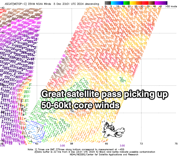
We then look towards the large W/SW groundswell due into early next week, with the strong low linked to it currently north of the Heard Island region, generating a fetch of storm-force W/SW winds. Satellite observations have picked up peak wind speeds of 55-60kts which is quite impressive, likely resulting in an upgrade in the expected peak in size.

The low will push east today while slowly weakening and then breaking down, with the groundswell due to arrive Monday morning, building strongly into the afternoon with a peak due later in the day/overnight before easing slowly Tuesday.
The South West looks to now reach 10ft to occasionally12ft at it’s peak with 3-4ft sets across Mandurah and 3ft sets in Perth, easing back Tuesday from 10ft, 3ft and 2-3ft respectively.
Local winds on Monday still look best for protected spots under strengthening S/SE-SE tending S-S/SE breeze in the South West with strong S/SW sea breezes to the north, best Tuesday as winds go fresh E/SE-SE during the morning.
Wednesday looks even cleaner with a straighter E’ly offshore but smaller, easing 4-5ft sets in the South West, tiny to the north.
Make the most of this swell as beyond it, the outlook is slower and with less favourable winds.
The next increase in decent swell looks to be out of the W/SW next weekend followed by some better energy the following week. More on this Monday, have a great weekend!

