Fun today and again Wednesday
Western Australian Surf Forecast by Craig Brokensha (issued Monday June 17th)
Best Days: Today, Wednesday, Thursday morning
Features of the Forecast (tl;dr)
- Easing W/SW swell tomorrow with strong SW tending S/SW winds in the South West, N/NE early to the north
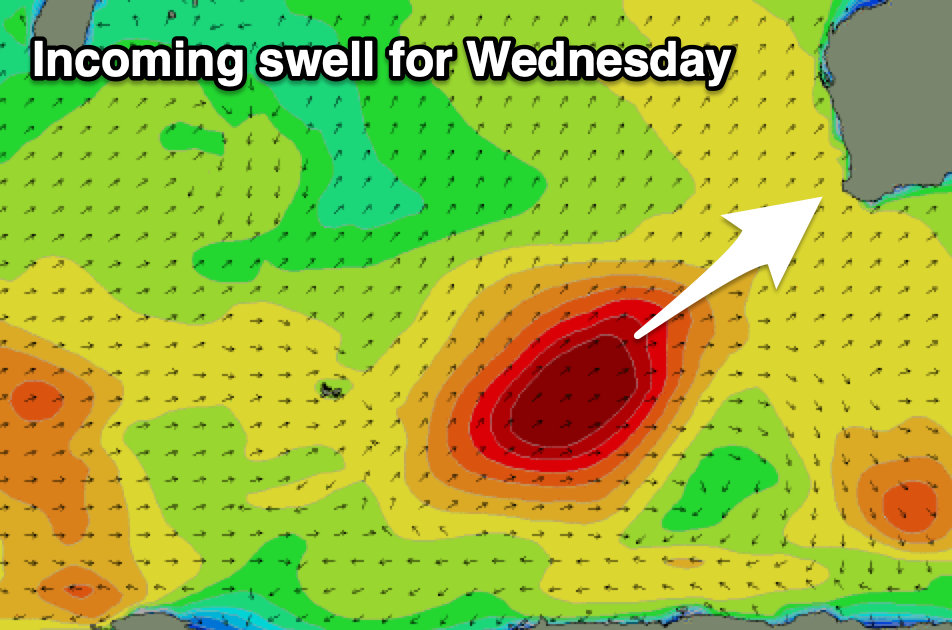
- Large SW groundswell filling in Wednesday, peaking during the PM with E/SE-SE tending S/SE-SE winds
- Easing swell Thu with freshening E/NE tending NE then N/NE winds
- Smaller Fri with strengthening N/NE tending N/NW winds (building N windswell)
- Large, stormy surf developing on the weekend with strong W/SW winds Sat, SW Sun and slowly easing
Recap
There was a window of good conditions with a new W/SW groundswell Saturday morning, coming in at 4-6ft in the South West and 2ft on the sets to the north, onshore Sunday while locations to the north offered OK waves towards northern ends.
A large, new mid-period W/SW swell built through the afternoon yesterday and has peaked today with 8ft surf in the South West, 2-3ft in Mandurah and 2ft across Perth with offshore tending variable winds.

Windy, clean surf early Saturday
This week and weekend (Jun 18 - 23)
Today’s swell is due to ease back into tomorrow as winds shift onshore thanks to the next swell producing front pushing up from the south-west.
Margs looks worst with strong SW tending S/SW winds, lighter N/NE to the north but with easing 2ft sets.
Wednesday should see improving E/SE-SE winds thanks to the swell generating front pushing off further east.

Swell wise, a great fetch of gales projecting up towards us should produce a large SW groundswell for Wednesday, possibly a touch undersized early (especially to the north) but reaching 10ft+ in the South West, 3ft across Mandurah and 2ft to possibly 3ft in Perth.
Winds look to hold from the S/SE-SE through the afternoon, keeping conditions fairly clean with easing surf under E/NE tending NE winds on Thursday morning N/NE into the afternoon.
Friday looks to be a lay day with smaller, fading surf under strengthening N/NE tending N/NW winds.
This will be ahead of a strengthening mid-latitude low pushing up and into us, bringing a fetch of strong to gale-force winds and localised increase in stormy swell on the weekend along with strong W/SW winds Saturday, weaker and easing SW on Sunday.
Into next week conditions should improve but with easing levels of mid-period swell, with more mid-latitude storm activity due into mid-late next week. More on this Wednesday.

