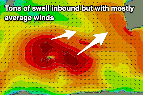
Tricky period between swell generating storms
Western Australian Surf Forecast by Craig Brokensha (issued Monday June 3rd)
Best Days: Tomorrow all locations, early Thursday selected locations Perth and Mandurah, Friday (from later morning in the South West)
Features of the Forecast (tl;dr)
- Easing swell tomorrow with variable winds in the South West, E/NE-NE to the north in the AM
- Large, inconsistent SW groundswell building Wed, peaking later, easing Thu
- Strengthening N-N/NW winds Wed (N/NE early Perth and Mandurah), similar Thu, kicking up some localised NW windswell
- Large mid-period W swell building Thu PM, peaking Fri AM
- Easing SW winds in the South West, tending variable with SE tending variable winds to the north
- Smaller Sat with NE to NW winds
- Building surf Sun with strong to gale-force W winds
Recap
Poor conditions and building surf on the weekend with a window of OK winds for the desperate around Perth and Mandurah early Saturday.
Today we’ve got XL surf with moderate to fresh onshore winds in the South West, cleaner but still lumpy and to the 4ft range in Mandurah, 3-4ft across Perth.
This week and weekend (Jun 4 - 9)
This morning XL swell has peaked and we’ll see it easing through this afternoon, further tomorrow as winds go more variable across the South West, E/NE-NE to the north, shifting N/NE and then N/NW into the afternoon.
With this variable breeze most locations are due to still be lumpy, so keep that in mind but we should see easing sets from the 8ft range, 2-3ft Mandurah and 2ft Perth.
Wednesday should see our inconsistent, SW groundswell arriving with it due to build through the day, peaking overnight, and easing from a similar size Thursday.

A strong and more distant polar low at the back of all the activity generating today’s swell is linked to the swell, with inconsistent but strong 8ft sets due across the South West at its peak, 2ft to maybe 3ft in Mandurah and 2ft across Perth.
Unfortunately winds will strengthen quickly from the N-N/NW on Wednesday (N/NE early Perth and Mandurah) thanks to the next approaching frontal system moving in from the west.
Similar winds are due into Thursday (shifting W/SW later) with a local north-west windswell due to kick up along with some new, mid-period W’ly swell, peaking Friday morning.
Size wise, we’re not expecting anything too major with surf to 10ft likely across Margs, 3ft in Mandurah and 2-3ft in Perth along with what looks to be rapidly easing winds in the wake of the front. Moderate S/SW-SW winds are due in the South West, tending variable through the day with SE tending variable winds to the north.
Smaller surf is due into the weekend and we’ll see the pattern repeating with increasing north winds ahead of a change and building swell through Sunday/Monday, though not cleaning up as quickly as it fades. More on this Wednesday.

