Swells from all directions with workable windows
Western Australian Surf Forecast by Craig Brokensha (issued Wednesday February 21st)
Best Days: Tomorrow morning protected spots, Friday morning, Monday morning in the South West, Wednesday morning
Features of the Forecast (tl;dr)
- Moderate sized mid-period W/SW swell building tomorrow, easing Fri
- Flukey, inconsistent W/NW cyclone swell building tomorrow, easing Fri
- Gusty S/SE winds Thu AM ahead of strong sea breezes, strong but easing E/SE Fri AM ahead of sea breezes
- Smaller Sat with strong S/SE-S winds
- Small-mod sized, mid-period SW swell for Sun with strong SE tending S/SE winds
- Easing swell Mon with E tending S/SW winds
- Better mid-period SW swell Tue/Wed with gusty S/SE winds Tue AM, E/SE-E Wed AM
- Larger SW groundswell likely late next week
Recap
A continuation of small, weak and clean waves across the South West yesterday morning, while today onshore winds have moved in across all locations with small to tiny surf.
This week and weekend (Feb 22 - 25)
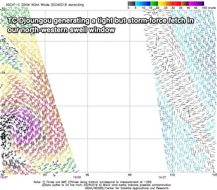
The coming days look interesting swell wise, thanks to some flukey W/NW groundswell arriving from Tropical Cyclone Djoungou which has been drifting south-east through the Indian Ocean the last couple of days.
It's been a tight, complex system with severe-gale to storm-force winds registered around its core, but over a very small area.

With this we should hopefully see building surf to an inconsistent 2-3ft across metro locations tomorrow afternoon, mixed in with some building mid-period W/SW energy, generated by a relatively weak polar front projecting up into the Indian Ocean. This swell should build to 4-5ft+ later in the day across Margs, easing from a similar size Friday morning, with Perth and Mandurah easing from 2-3ft.
Winds will be less than ideal and gusty from the S/SE through the morning, tending stronger S-S/SW into the afternoon when the swells kick in proper, best Friday morning and strong but easing from the E/SE ahead of sea breezes.
Moving into the weekend, winds will revert back to the S/SE and with strength Saturday with smaller, easing surf while Sunday should see some new mid-period SW swell in the mix along with strong SE morning winds.
The mid-period swell which should be backed up by a stronger pulse later Monday but more so Tuesday will be generated by a broad, healthy and strengthening frontal progression developing south-west of us from today, persisting into the weekend and likely early next week.

An initial burst of strong W/SW winds should produce a kick in size Sunday to the 4ft range or so in the South West, tiny to the north, easing Monday with E/SE winds.
Tuesday's pulse looks better and to 4-5ft+ with 1-1.5ft sets to the north but with a return to average S/SE tending S/SW winds. Wednesday looks cleaner again with a possible third, reinforcing pulse of similar sized swell but we'll have a closer look at this Friday.
Longer term, a larger SW groundswell is on the cards for late in the week thanks to a stronger frontal system firing up on the tail of the coming progression. Winds look to have a southerly bias but we'll review this Friday.

