Relentless run of onshore winds
Western Australia Surf Forecast by Craig Brokensha (issued Wednesday July 5th)
Best Days: Perth and Mandurah tomorrow morning, Saturday morning, early Sunday, Monday morning, Wednesday morning
Features of the Forecast (tl;dr)
- Relentless onshore winds for the South West from the north-western quadrant
- Windows of lighter winds and fun sized sets for Perth and Mandurah tomorrow morning, Saturday morning, early Sunday and Monday morning
Recap
Very large stormy surf building across the South West yesterday though with strong to near gale-force onshore winds, there were little to no options. To the north the swell was also a mess, with all locations easing a touch this morning with strong SW breezes.

This week and weekend (Jul 6 - 14)
Buckle up, it looks like the Margaret River region will continue to see poor conditions, onshore winds and pulses of large surf through the whole period.
This will be thanks to a strong, persistent negative Southern Annular Mode mode (SAM) which lifts the Southern Ocean frontal activity further north, closer to Australia.

Add to this a strong, slow moving node of the Long Wave Trough which is currently positioned across the state, helping to draw the activity in and across us.
This node will shift slowly east through the end of the week, but we'll only see a weak ridge move in behind it. This means the South West will cop persistent winds out of the western quadrant, with windows of variable winds opening up to the north at times.
One of these times will be tomorrow morning with variable E/NE winds due across Perth and Mandurah with a further drop in size from today. Expect lumpy 3ft waves across Mandurah and 2-3ft sets in Perth ahead of strengthening W'ly winds into the afternoon.
Strong W/SW winds will move in across all locations on Friday as a strengthening front pushes up and under us, bringing some new mid-period SW swell that's expected to peak Saturday.
Margs will remain onshore with fresh W/SW winds, lighter and E/NE to the north in the morning along with fun 3ft sets across Mandurah and 2-3ft in Perth.

Sunday's window of favourable winds in Perth and Mandurah will be shorter with an early N/NE-NE breeze, shifting W/NW and increasing through the day. The swell will be easing from Saturday and a little under the size seen the day before.
Monday looks to see morning NE winds again to the north along with a new, building SW groundswell, linked to a fast tracking but strong mid-latitude front pushing east while generating gale to severe-gale W'ly winds.
Mandurah should build back to 3ft through the afternoon but as winds increase from the N/NW (smaller earlier) with Perth kicking back to 2-3ft. Tuesday looks dicey regarding a morning window of favourable winds with the next front likely to bring strong N/NW winds through the day.
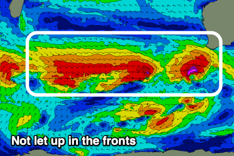
A larger W/SW groundswell is on the cards for the middle of next week thanks to a significant fetch of severe-gale W/NW winds moving in behind Sunday's front. The swell is expected Tuesday afternoon and Wednesday morning but with strong winds from the NW-N/NW. Besides a possible early fresh N/NE breeze Wednesday morning conditions look generally average.
Unfortunately there's no real end in sight to the frontal activity at this stage so hang in there if you're living down south.

