Slow period with small windows
Western Australian Surf Forecast by Craig Brokensha (issued Friday April 1st)
Best Days: Protected spots Sunday afternoon and Monday, Tuesday morning in the South West, Thursday morning in the South West
Features of the Forecast (tl;dr)
- Moderate sized + mid-period W/SW swell buulding Sun, peaking into the PM, easing Mon
- Strengthening S/SE winds Sun, fresh to strong S/SE-SE Mon
- Easing surf Tue with morning E/SE winds
- Small, mid-period W/SW swell Thu with E/NE tending N/NW winds
- Easing swell Fri with S/SW winds
- New moderate sized SW groundswell next Sat with S/SE winds
Recap
Fading surf with clean conditions and small 2-3ft sets across the Margs magnets yesterday morning, 1-2ft max today.
This weekend and next week (Apr 2 - 8)
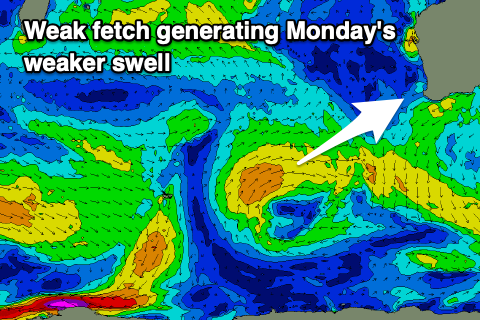
 Tomorrow will be another lay day with the swell remaining at a low point but come Sunday, our new mix of mid-period W/SW swells should fill in. The source of this surf was back to back mid-latitude frontal systems pushing towards us the last few days, with the secondary system producing a weak fetch of strong W/SW winds south-west of us today and tomorrow. This will slow the easing trend in size through Monday, but coming back to Sunday and we should see building surf to 5-6ft through the afternoon across the South West, 2ft in Perth and Mandurah, easing from a similar size Monday morning.
Winds will favour protected spots with this incoming swell as a high pressure system moves in from the west, bringing strengthening S/SE winds on Sunday (lighter SE further north in the morning), holding fresh to strong from the S/SE on Monday.
Tuesday will still be fun in the South West but easing with offshore E/SE winds and fading 3ft+ sets.
 Wednesday will be clean again with a low point in swell ahead of some new mid-period W/SW energy on Thursday, generated by an elongated but weak frontal system moving in through the Southern Ocean on the weekend. Size wise it looks to be under Sunday and Monday’s swell with 3-5ft sets across the South West with tiny surf in Perth and Mandurah. Winds look favourable and out of the E/NE through the morning ahead of northerly sea breezes.
A strong tailing fetch of gale-force W/SW winds should generate a better SW groundswell for Saturday though winds will revert back to the S/SE as a new high pressure system slides in behind a trough on Friday.
Longer term the outlook remains relatively quiet with nothing major showing on the charts, but check back here on Monday for an idea on when we might see out first significant swell of the season. Have a great weekend!

