Good swells inbound but winds are tricky
Western Australia Surf Forecast by Craig Brokensha (issued Monday March 14th)
Best Days: Thursday morning, protected spots Friday morning and Saturday, Sunday morning
Features of the Forecast (tl;dr)
- Large mix of mid-period and groundswell building Thu PM, easing Fri AM with light, variable SE tending S/SW winds on Thu, S'ly tending strong SW winds on Fri
- Reinforcing SW groundswell building Sat, peaking in the PM with strong S/SE winds, easing Sun with E tending W winds
- Smaller, mid-period SW swells next week
Recap
Light winds but a small swell Saturday, building out of the S/SW through the day and fun Sunday with offshore winds and easing 3ft sets. Today the surf is back to 2ft but nice and clean.
Perth and Mandurah remained tiny along with light morning winds.
This week and weekend (Mar 15 - 20)
As touched on last week, the next two days will be lay days with a low point in swell and developing onshore winds tomorrow (Perth and Mandurah), stronger on Wednesday as a mid-latitude front pushes into us.
Fear not as this will bring a large pulse of SW groundswell and winds are still favourable once the front clears into the end of the week.
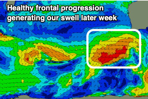
 This front will develop around the Heard Island region this evening and project towards us while generating a fetch of strengthening W/SW gales.
It'll clip us Wednesday, bringing an increase in localised windswell ahead of a mix of mid-period swell and groundswell building Thursday, peaking overnight and easing Friday.
Size wise the South West should build to 6-8ft, easing from a similar size Friday morning with Mandurah and Perth building later in the day Thursday, easing from 2-3ft and 2ft+ respectively Friday morning.
Winds should ease off overnight Wednesday and become variable into Thursday, tending light SE through the morning in the South West, E/SE further north. Friday will see slightly less favourable S'ly tending SW winds, strengthening into the afternoon. So try protected spots.
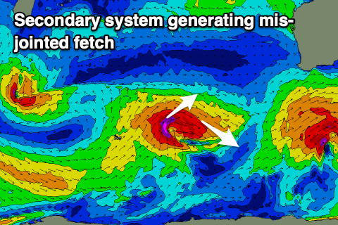
 A fun, reinforcing SW groundswell is due to fill in on the weekend, generated by a secondary mid-latitude front, though this one a bit poorly structured, with a fetch of pre-frontal W/NW gales followed by post-frontal W/SW gales.
It looks to build to the 6ft+ range in the South West Saturday afternoon, easing from 4-6ft Sunday with 2ft sets in Mandurah, 1-2ft across Perth.
Strong but abating S/SE winds are due on Saturday with E'ly winds Sunday as the swell eases (the pick of the weekend).
Longer term the Southern Ocean becomes a little more quiet, generating mid-period swell energy but we'll have a closer look at this on Wednesday.

