Great surf over the coming days
Western Australian Surf Forecast by Craig Brokensha (issued Wednesday February 16th)
Best Days: Thursday morning all locations, Friday all locations, Saturday morning protected locations, Sunday morning in the South West, Monday morning South West magnets
Features of the Forecast (tl;dr)
- Mod-large SW groundswell tomorrow with mod-fresh E/SE tending strong S/SW winds
- Easing SW groundswell Fri with fresh E/NE tending lighter NW then fresh SW winds
- Reinforcing mod-large SW groundswell Sat with early S/SE tending strong S/SW winds
- Easing SW groundswell Sun with fresh SE tending stronger S/SE winds
- Small fading surf Mon with E/SE tending S/SW winds
Recap
A fun reinforcing pulse of SW swell to 3-5ft across the South West yesterday and 1-1.5ft in Mandurah with tiny options across Perth.
Today the swell is smaller with less favourable winds, a lay day.
This week and weekend (Feb 17 - 20)
 We’ve got a great SW groundswell due to fill in tomorrow, generated by a strong, slow moving polar low the last two days, firing up east of the Heard Island region. There may be signs of long-period energy showing later today but we should see a peak tomorrow to a strong 8ft on the sets across the South West, 2ft to likely 3ft in Mandurah and 2ft on the sets in Perth.
Winds look great and moderate to fresh from the E/SE in the morning, giving into stronger afternoon sea breezes, with fresh E/NE tending lighter NW then SW winds oN Friday as the swell eases.
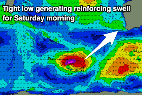
Our reinforcing pulse of SW groundswell for Saturday is on track, generated by a very strong but small low that’s currently developed just east of the Heard Island region again. A fetch of severe-gale to storm-force W’ly winds are being generated, with the swell due to kick wave heights back up into Saturday morning to 6ft+ across the South West, 2ft in Mandurah and 1-2ft across Perth.
 Winds aren’t as favourable with an early S/SE breeze due to shift S/SW and strengthen, a bit better Sunday though still fresh from the SE.
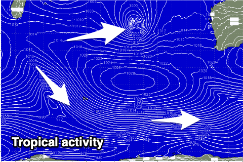
The surf will fade into the start of next weekend as winds swing more offshore but we’ll be lucky to see 2-3ft sets on the South West swell magnets Monday morning. Longer term, as touched on in the last update, tropical activity throughout the Indian Ocean will keep a lid on any major swells being generated for us with some weak, mid-period energy due later next week. We may see a better groundswell into the weekend but check back here Friday for more details. In the meantime make the most of the coming swells.


Comments
see typo "Jan 17-20"
Ah yep.
Will these swells hit the mid north west Craig? also will that tropical cyclone produce any swell or just block lows out of the equation?
Yep, just have a touch of south in them, but the first, today's will hit better than Saturday's.
A bit slow early but some better sets now showing. Windy though!
Defo on the kick now, both size and period
Nice!