Good surf developing from Sunday
Western Australia Surf Forecast by Craig Brokensha (issued Friday August 20th)
Best Days: Sunday all locations (Margs into the PM), Monday all locations, Tuesday all locations, Wednesday morning in the South West
Features of the Forecast (tl;dr)
- Large, mid-period W/SW swell for tomorrow with strengthening W/SW winds
- Large SW groundswell building Sun, peaking into the late PM with strong S/SW winds, easing and tending S/SE in the South West (S/SE-SE tending S/SW in Perth and Mandurah)
- Large, easing SW groundswell Mon with moderate to fresh E/NE tending E/SE winds
- Smaller Tue with strong E/NE winds, easing later
- Inconsistent SW groundswell filling in Wed, peaking into the PM with strong E/NE tending N winds
Recap
Onshore winds and moderate sized surf across the South West yesterday and today, with variable but funky conditions in Mandurah owing to onshore winds sitting just off the coast. Perth was cleaner but lumpy and peaky overall.
This weekend and next week (Aug 21 - 27)
We've got one more day of onshore winds across the South West (and further north) and then expect conditions to slowly improve through Sunday, becoming much better early next week.
A mid-latitude front that's currently weakening under us will bring a mid-period increase in swell tomorrow, kicking the South West to 6-8ft, 2-3ft in Mandurah and 2ft+ in Perth.
 Winds will strengthen from the W/SW ahead of the next approaching frontal system. It also looks likely that Perth and Mandurah won't see early variable winds and will be onshore from the get go.
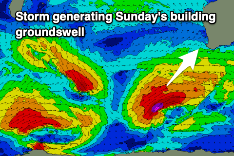
Looking at the polar low generating Sunday's oversized SW groundswell and unfortunately there's been a further drop in the expected size with the low now looking a little less consolidated and not as well structured.
We're due to see a fetch of gale to severe-gale W/SW winds projected up towards us over the coming days, passing under the country Sunday, out of our swell window.
We'll still see a good quality, large SW groundswell filling in Sunday from late morning and peaking into the late afternoon (evening Perth and Mandurah).
 Size wise the South West now looks to reach 10ft+, 3-4ft in Mandurah on dark and 3ft in Perth. In the morning Mandurah should be 2-3ft and Perth 2ft.
Winds look similar to forecast on Wednesday with a strong but easing S/SW tending S/SE breeze due in the South West, opening up protected locations as the swell fills in with S/SE-SE morning winds to the north, S/SW into the afternoon but then back to the S/SE later.
Monday still looks great with a moderate E/NE tending E/SE breeze and large, easing SW groundswell from 8-10ft in the South West, 3ft in Mandurah and 2-3ft across Perth.
Tuesday will remain clean but see the swell easing further with a strong E/NE breeze, easing into the afternoon.
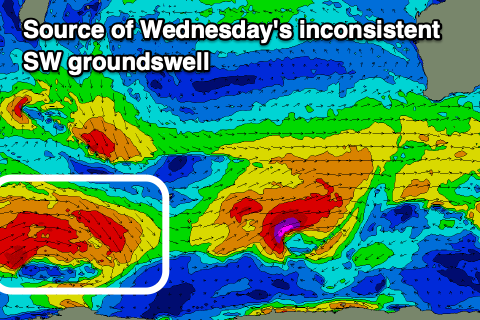
 Strong E/NE winds are again due Wednesday morning, though shifting N into the afternoon. The models are picking up a long-period signal through the day, generated by a distant storm south-east of South Africa. It'll be moderate in size and build to around 4-5ft on the sets across the South West through the day, small and to 1-2ft in Mandurah, tiny across Perth.
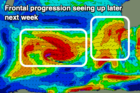
From here, things go back onshore as a series of polar come mid-latitude systems push up and into the state, bringing onshore winds and building surf.
The models still diverge on the intensity of this progression and the size of the incoming swells, but we're likely to see oversized surf into next weekend but with W winds. More on this Monday and next week. Have a great weekend!


Comments
Hows the period band heading north 4th/5th Sept
Now showing 31st Aug/1st Sept
Pumping this morning!
Speccy backwash at Mandurah too.
It's on days like these that work really sux.
that is speccy Ben, morning high tides