One down, two to go
Western Australia Surf Forecast by Craig Brokensha (issued Monday 9th March)
Best Days: Mandurah and Margs (early) tomorrow morning, Wednesday across the South West, Thursday protected spots, Friday, Saturday and Sunday in the South West
Recap
Poor surf all round with no size across any coast and average winds, cleanest yesterday morning.
Our first pulse of SW groundswell for today has come in as expected with clean 5-6ft waves across the South West, 2ft in Mandurah by late morning and 1-2ft now in Perth.

This week and weekend (Mar 10 - 15)
Today's pulse of SW groundswell is the first of three due this week, with it easing in size tomorrow and further Wednesday morning.
 Margs and Mandurah will be the pick tomorrow as it eases with dropping sets from 3-5ft across the magnets, 1ft to possibly 2ft in Mandurah, 1-1.5ft across Perth. An early SE breeze is due to switch S/SE through tomorrow morning in the South West (so get in early), E/SE further north ahead of afternoon sea breezes.
Wednesday morning should then see a SE-E/SE offshore ahead of sea breezes.
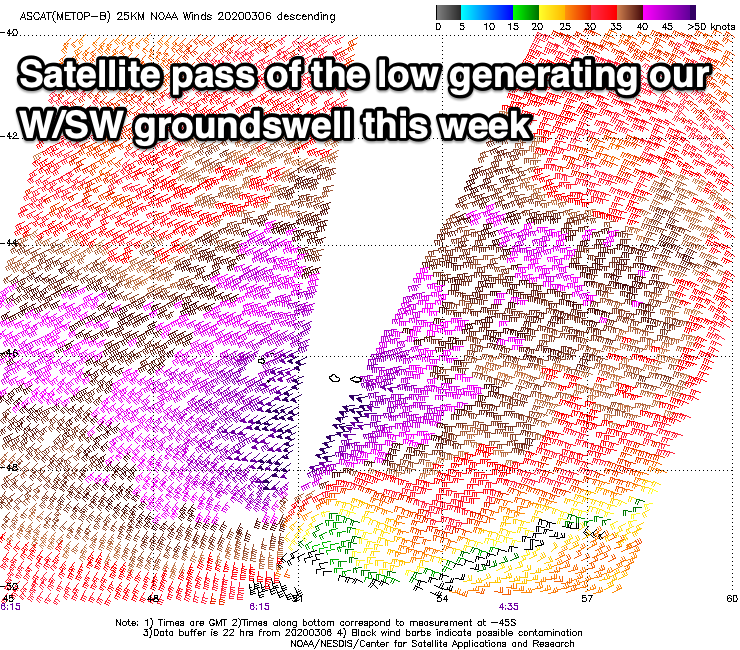
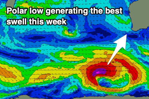
Into the afternoon our new pulse of W/SW groundswell is still on track, with a more northerly positioned but more distant low forming south-east of South Africa late last week. A stronger fetch of severe-gale to storm-force W/SW winds were projected through our western swell window, with an inconsistent W/SW groundswell due to kick Wednesday afternoon and reach 5-6ft by dark in the South West, 2ft in Mandurah and Perth before peaking overnight.
Thursday morning looks to offer similar sized surf ahead of a larger and more consistent S/SW groundswell building through the day and peaking into the afternoon.
The source of this S/SW groundswell is a strong polar frontal progression that's just formed east of the Heard Island region. A fetch of pre-frontal gale to severe-gale W/NW winds will be followed by post-frontal severe-gale W/SW winds, producing a good, long-period S/SW groundswell.
Size wise, there's no change to Friday's forecast size, with a kick to a larger 8ft or so across the South West magnets into the afternoon, 2-3ft in Mandurah and hold 2ft in Perth.
The swell should then ease Friday from 6-8ft, 2-3ft and 2ft respectively.
Looking at the local winds on Thursday and we've got less favourable and fresh S/SE breezes due through the morning, stronger into the afternoon (S/SW in Perth and Mandurah) so stick to protected breaks.
 Friday looks excellent with a fresh SE tending E/SE breeze, possibly holding all day as an inland surface trough starts to deepen and drift south.
Fresh and gusty E tending E/NE and then NE winds on Saturday will continue to create good conditions on Saturday as the swell eases, offshore again Sunday with a background SW groundswell.
The source of the background swell is well south of South Africa over the weekend, resulting in a very inconsistent and small swell to 3ft to possibly 4ft in the South West, tiny to the north.
Longer term, smaller mid-period SW swells are on the cards for next week from weak but persistent polar frontal activity though winds might go a little funky depending on how the trough pans out. More on this Wednesday.


Comments
Beautiful moonset this morning..