Excellent surf next week
Western Australia Surf Forecast by Craig Brokensha (issued Friday 14th June)
Best Days: Perth and Mandurah tomorrow morning, all locations Monday and Tuesday morning, Wednesday morning Margs and Thursday, Friday all locations
Recap
Poor onshore conditions continued across the South West yesterday, similar today with the swell hanging in at 5-6ft.
Perth and Mandurah saw variable winds yesterday morning and OK though not great conditions for a surf, much better today with clean 2-3ft waves in Mandurah, 2ft in Perth.
Today’s Forecaster Notes are brought to you by Rip Curl
This week and weekend (Jun 15 - 21)
It'll be a poor weekend of surf around Margs as today's swell slowly eases tomorrow as onshore SW winds persist. Perth and Mandurah should be clean with morning E/NE winds and 2ft+ sets across Mandurah magnets, 2ft max in Perth.
Sunday will be smaller again as onshore W/SW winds hang in around Margs, light NE early around Perth and Mandurah but becoming tiny.
 We move on to next week and the extra-large long-period SW groundswell event due across the state.
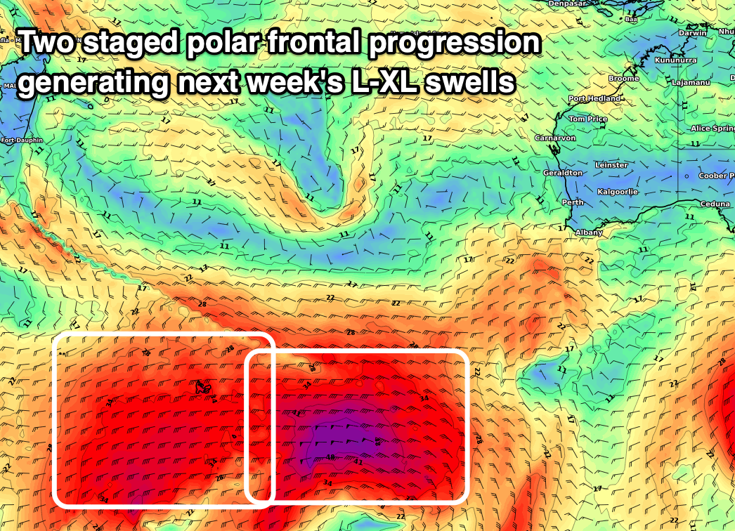
As touched on Wednesday, there are two seperate pulses due early next week owing to the strong polar frontal progression that's currently around Heard Island region generating two seperate fetches.
Firstly a storm-force fetch of W'ly winds are being generated south of the Heard Island region, with this fetch pushing east and through our south-western swell window today, weakening overnight.
This will be then quickly followed by a broader and slower moving fetch of severe-gale W/SW winds projecting up towards us and then under the country over the weekend.
The storm-force fetch will generate the largest period SW groundswell energy, arriving overnight Sunday and peaking Monday morning to 10-12ft across the South West, 3ft in Mandurah and an inconsistent 2ft to occasionally 3ft in Perth.
The secondary pulse of reinforcing but slightly lower period SW groundswell should arrive into the afternoon, kicking wave heights further to 12-15ft across the South West magnets, 4ft in Mandurah and 3ft in Perth.
We'll then see both swells easing into Tuesday from 10-12ft in the South West, 3ft+ in Mandurah and 2-3ft Perth.
We're still expected to see a high move in quickly on Monday, swinging winds offshore out of the E/SE through the morning, though likely SE at dawn, and best later morning ahead of sea breezes. Perth and Mandurah look to see SE tending S/SW winds.
 Tuesday looks clean again with an E/SE offshore breeze (E/NE in Mandurah and Perth) as the swell eases. Wednesday is looking great with an E/SE offshore, best around Margs as the swell continues to ease.
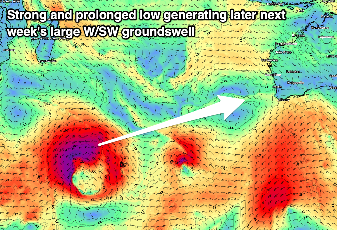
Longer term, a large new long-period W/SW groundswell is due across the state Friday, produced by a distant but very significant low forming south of South Africa tomorrow.
This will will expand in scope and project an excellent fetch of sustained storm-force W/SW winds through our western swell window Sunday and Monday morning, easing into the evening as it cross the Heard Island region, continuing to weaken thereafter.
Size wise we're looking at infrequent but strong 10ft to possibly 12ft in the South West, 3-4ft in Mandurah and 3ft in Perth along with an offshore breeze, but we'll confirm this Monday. Have a great weekend!

