Large swells on the way but winds will go funky
Western Australia Surf Forecast by Craig Brokensha (issued Wednesday 29th May)
Best Days: Friday afternoon protected spots, Saturday, Sunday morning selected locations, Monday and Tuesday selected locations
Recap
Great waves across the South West swell magnets yesterday and this morning, with a temporary drop in swell yesterday morning ahead of a new long-period S/SW groundswell building into the afternoon, holding 4-5ft this morning. Perth and Mandurah have remained clean but tiny.
Today’s Forecaster Notes are brought to you by Rip Curl
This week and weekend (May 30 – Jun 2)
Tomorrow is looking poor as today's inconsistent S/SW groundswell eases this afternoon, smaller into tomorrow the morning with a strong N/NE tending N winds.
Later in the day a new W/SW groundswell should be seen, generated by a short burst of gale to severe-gale W'ly winds in our swell window at the start of this week. A late pulse in size to 4-5ft+ is due tomorrow, peaking Friday morning to 5-6ft. Winds will be onshore pre-dawn and out of the W/SW, tending S/SW dawn and then around to the S/SE through the late morning/afternoon creating improving conditions.
 Later in the day some new mid-period W/SW swell may be seen, ahead of a larger and stronger W'ly groundswell on Saturday morning.
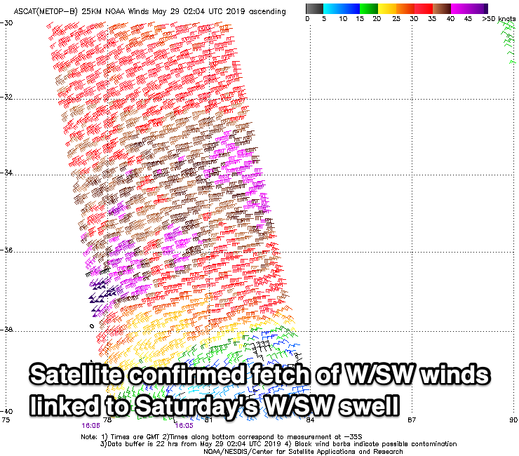
This swell is being produced by a strong mid-latitude front that's currently positioned due west of Perth and north-east of the Kerguelen Islands. A fetch of gale to severe-gale W/SW winds have been generated, with even a couple of storm-force barbs registered, but the system is now weakening and will continue tracking east before dipping south-east away from us tomorrow afternoon and evening.
If this were positioned a little more south I'd expect 10-12ft waves across the South West but with it a little more north and aimed better towards Indonesia and the North West of the state I'm a little cautious. We should see large 10ft sets across the South West out of a W'ly direction, 3-4ft in Perth and Mandurah, easing through the day.
Winds are still looking great with a fresh offshore E/SE tending E/NE breeze, lighter N/NE into the afternoon opening a wide variety of options as the swell eases.
N/NE winds will limit options on Sunday with easing 6ft+ sets across the South West, 2-3ft in Mandurah and 2ft in Perth.
Another strong but further south positioned mid-latitude low is due to fire up north of the Heard Island region Thursday evening, projecting a great fetch of gale to severe-gale W/SW winds towards us through Friday and Saturday before dipping away from us Sunday.
A large and powerful W/SW groundswell should build Monday, reaching 8ft+ later in the day in the South West, 3ft in Mandurah and 2-3ft in Perth, peaking Tuesday morning to 8-10ft, 3ft and 2-3ft respectively before easing.
Winds will unfortunately be dicey and out of the NE tending N/NE on both Monday and Tuesday, limiting surfing options, more N'ly Wednesday and stronger as the swell eases.
Longer term the outlook is tricky with funky mid-latitude storms developing to our west, but more on this Friday.

